6:25 PM Saturday, April 20, 2024
Early next week, rain may occur from late Monday afternoon into Tuesday due to a low-pressure area and cold front, accompanied by an upper-level trough, moving east-southeast from southwest Canada and the northern Rockies.
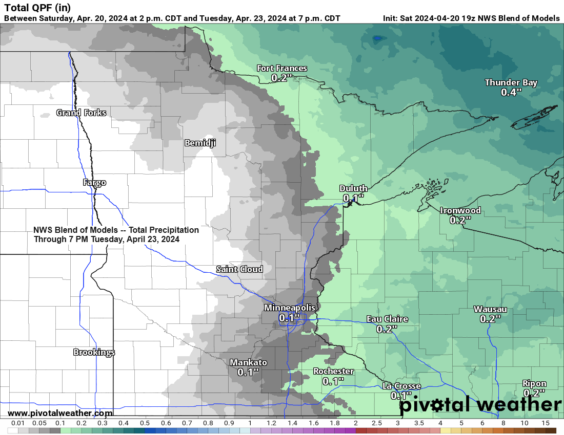
While heavy rain is not expected with the upcoming system early next week, some scattered precipitation is likely to occur in the Northland area.
Rainfall amounts of approximately 0.05 to 0.25 inches could occur in northeast Minnesota and northwest Wisconsin from late Monday afternoon into Tuesday.

There is also a possibility of a brief snowfall or a rain-snow mixture in parts of the Northland next Tuesday due to a surge of colder air moving south from Ontario, although snowfall totals are expected to be less than an inch.

It appears that the weather pattern will reset late next week, with a trough reestablishing over the western U.S. and an upper-level ridge to the east.
Multiple low-pressure systems may emerge from the western trough and traverse the Plains and upper Midwest late next week into the following week. These systems have the potential to deliver rain to the Northland and may even trigger a few thunderstorms if sufficient instability arises in the region.

The ensemble models concur strongly about the development of a wet pattern late next week, extending into early May, with widespread precipitation totals of 1 to 2 inches or more.


This morning’s overcast skies cleared up, bringing abundant sunshine to much of the Northland by the afternoon. However, late in the afternoon, we observed a new cluster of clouds moving south-southeast from northern Minnesota.
Goes-16 visible satellite loop from Saturday, April 20, 2024. Loop time ends 5:01 PM CT.

The increased sunshine this afternoon led to a temperature rise of approximately 10 degrees compared to what was experienced on Friday afternoon.

Note: Today, Saturday, April 20th, represents the fifth consecutive day that Duluth has experienced peak wind gusts of at least 30 mph. Expect breezy conditions to persist into Sunday and Monday, with anticipated wind gusts ranging from 20 to 30 mph. Westerly winds on Sunday will shift, coming more from the southwest on Monday.
Regarding temperatures, they were in the 40s throughout the region this afternoon.

Thanks for reading!
Tim
Leave a Reply