6:09 PM Thursday, June 20, 2024
Over the next few days, northeast Minnesota and northwest Wisconsin will experience occasional rain, but the likelihood of heavy rainfall with this system has greatly decreased across much of the region.
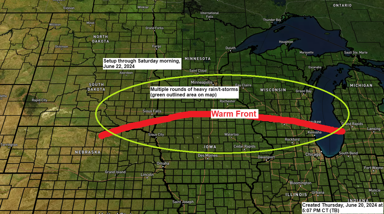
It seems there will be two primary periods of rainfall through Saturday. The initial phase is expected during Friday, predominantly impacting northwest Wisconsin, eastern Minnesota, and the Twin Ports area, while northern Minnesota is likely to remain mostly dry. The subsequent bout of rain might take place late Friday night into Saturday morning, potentially encompassing a broader area of the Northland than the first.
The most significant rainfall through Saturday is expected in southern Minnesota, eastern South Dakota, and parts of western and central Wisconsin. These regions may receive 2 to 4 inches or more of rain by the end of Saturday.

NAM 3km model simulated radar forecast through 7 PM Saturday.

Here are a few different computer model forecasts for rainfall totals through 7 PM Friday. Observe the variations in how far north the rainfall extends on Friday according to these models.
The Euro and RAP models predict a fair amount of rain in Duluth on Friday, with totals reaching up to half an inch. Conversely, the NAM 3km and HRRR models forecast only light rainfall for Duluth on the same day.


Flood Warnings and advisories remain in effect in parts of northeast and east central Minnesota through Friday.
-Numerous structures are flooded and flood mitigation efforts continue within the city of Cook. Numerous roads remain closed across northern and western St. Louis County due to flooding.
-Flooding of larger rivers and other low-lying and flood-prone locations is occurring. Smaller creeks and streams continue to remain elevated.
-Numerous roads remain closed due to flooding.

-Water continues to flow over County Highways 4 and 63 and 135 and 161 in Northern Cass County as of 9:30 AM Thursday morning.

Green – Flash Flood Warning
Red – Tornado Warning
Yellow – Severe Thunderstorm Warning
Radar loop ends 5:28 PM Thursday, June 20, 2024.
The weather pattern persists today, with a large ridge dominating the southeast/eastern U.S. and a trough extending from the western U.S. into central Canada. The upper Midwest is experiencing an active southwest flow aloft, caught between the eastern ridge and the western trough.

Thanks for reading!
Tim
Leave a Reply