5:09 PM Tuesday, July 16, 2024
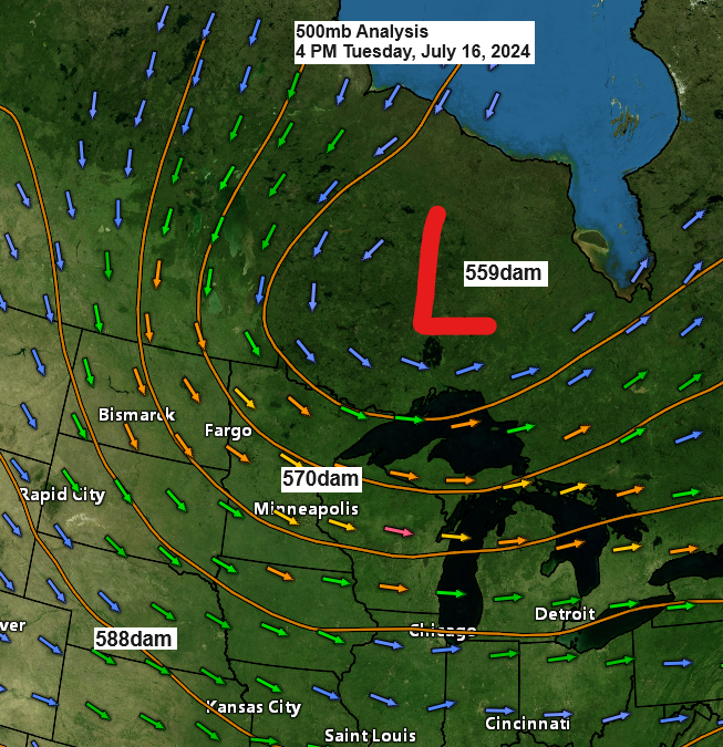
A trough from Ontario, Canada, is causing 500mb heights to lower while also bringing cooler and less humid air to the Northland.
This trough is also bringing a few showers to parts of the Northland this afternoon, and these showers will persist in a scattered fashion into this evening before we dry out overnight. Then, we will remain mostly dry for the next few days.
Highs on Wednesday will be in the upper 60s to the low to mid-70s across the Northland, with temperatures mostly in the 70s and lower 80s from Thursday through the weekend.
Overnight temperatures will drop to the 40s and 50s in the Northland tonight and again on Wednesday night.
Scattered showers will keep moving southeast across northeast Minnesota and northwest Wisconsin later this afternoon and evening, with the possibility of a brief downpour in some areas, but many of us may not get any rain.
Radar loop ends 4:54 PM CT, Tuesday, July 16, 2024.
Where it rained, it’s in the 60s, but where it’s sunny, it’s in the 70s this afternoon.

Lake Superior is warming up, with most areas experiencing water temperatures in the 60s and some reaching the lower 70s near the shoreline. However, there are cooler pockets in the low to mid 50s, including one around the Isle Royale area and another over part of eastern Lake Superior.

The current water temperature of Lake Superior is above the average for this time of year.

Over the past few days, there have been heavy rainfalls in northern Minnesota and southern parts of northwest Wisconsin. However, Duluth has only received 0.01 inches of rain since Sunday.

Thanks for reading!
Tim
Leave a Reply