6:44 PM Tuesday, August 13, 2024
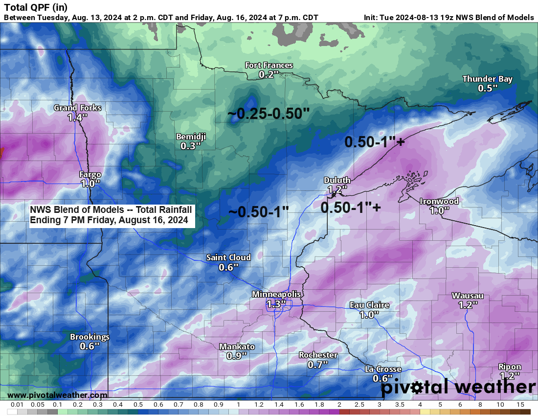
Later this week, the Northland will experience a rainy system due to an area of low pressure moving northeast from southwest Minnesota. The majority of the rain is expected to occur from Thursday to Friday morning, with the heaviest rainfall—ranging from half an inch to over an inch—likely in northwest Wisconsin, far eastern Minnesota, and along the North Shore of Lake Superior in northeast Minnesota. Northern Minnesota is anticipated to receive smaller amounts of rain.
Rainfall anomalies for August 2024 as of 4 PM on August 13th.
- International Falls, MN: -0.85″ below normal
- Ashland, WI: -0.73″ below normal
- Duluth, MN: -0.41″ below normal
- Hibbing, MN: -0.17″ below normal
- Brainerd, MN: +0.29″ above normal
Expect cooler temperatures on Thursday and Friday, as increased cloudiness and rainfall are anticipated. The forecast predicts highs in the 60s and 70s for these days, with Thursday likely being the coolest.
The computer models indicate a northward shift in the track of the low for later this week. However, even with this shift, the projected rainfall amounts for the Northland remain largely unchanged.
Note: As low pressure moves northeast from southwest Minnesota, it is expected to generate gusty northeast winds around the Lake Superior and Twin Ports area on Thursday, with potential wind gusts ranging from 25 to 35 mph.

The system set to impact the Northland on Thursday and Friday is presently traversing the Pacific Northwest and Rockies, and its presence is pronounced on today’s water vapor imagery.
Goes-16 water vapor loop ending 6:31 PM CT Tuesday, August 13, 2024.

Thanks for reading!
Tim
Leave a Reply