6:07 PM Wednesday, August 14, 2024
Following several warm and predominantly dry days in our region, the weather will shift to cooler temperatures with occasional rain on Thursday and Friday. However, the forecast suggests a return to warmer and drier conditions for the approaching weekend.
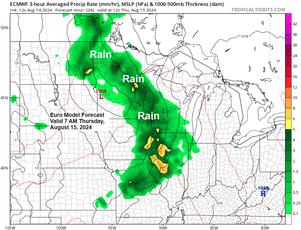
A low-pressure area located over the far northern region of Nebraska and the far southern region of South Dakota this afternoon is expected to move northeastward into eastern Minnesota by late Thursday afternoon. Following this trajectory, the system is anticipated to arrive in the northern areas of Wisconsin by early Friday morning.
Note: In a few months, such a storm track could result in a significant snow event across much of the Northland, complete with gusty northeast winds and blowing snow near Lake Superior. However, it’s only August, so there’s no need for concern just yet.
The approaching low-pressure system will generate lift, resulting in rainfall across northeast Minnesota and northwest Wisconsin starting late tonight and continuing into Friday. However, the bulk of the precipitation from this system is expected to occur late tonight and throughout Thursday.
Duluth area: Rain is expected to start early Thursday morning, between 5 and 8 AM, and will likely continue with intermittent rain and drizzle throughout the day.
Note: Patchy fog may develop near Lake Superior from Thursday into Friday morning, owing to the moisture from the rain and the northeasterly winds off the lake, which will contribute additional moisture to the air. Moreover, these northeast winds may cause lake-enhanced rainfall, primarily along the North Shore of Lake Superior on Thursday.

The HREF model indicates a likelihood of increased rainfall totals due to lake enhancement with this system, predicting approximately 2 to 3 inches of rain along the North Shore of Lake Superior by 7 AM Friday.

On average, northern Minnesota is forecasted to receive about a quarter to a half-inch of rain by 7 AM Friday. Meanwhile, northwest Wisconsin, east central Minnesota, and areas near Lake Superior are expected to see a half-inch to an inch or more of rainfall.

Over the past day, significant smoke has blanketed parts of northeast Minnesota, originating from wildfires in Saskatchewan and Manitoba. This smoke has traveled to northeast Minnesota, and dense ground-level smoke has settled near Lake Superior, leading to reduced visibility.
Note: An Air Quality Alert, indicated by the orange area on the map, will remain in effect for northeast Minnesota until 6 AM Thursday. The smoke is expected to clear with the arrival of rain on Thursday.

Radar loop ends 5:50 PM CT Wednesday, August 14, 2024.
NAM 3km model simulated radar forecast valid from Midnight tonight to Midnight Friday.

The incoming trough from the west is expected to enhance uplift over the Northland on Thursday, which should contribute to rainfall in our region.

The approaching system, as seen on water vapor imagery, appears particularly impressive for this time of year.
Goes-16 water vapor loop ending 5:21 PM CT Wednesday, August 14, 2024.

In Duluth this month, 43% of the days have recorded temperatures below the average, while 36% have experienced temperatures above the average.

The forecast predicts high temperatures will generally range in the 60s to near 70 degrees on Thursday and Friday in the Northland, with mid-70s to lower 80s expected for Saturday and Sunday.
On the maps below, blue indicates temperatures below normal, and orange signifies temperatures above normal.


Thanks for reading!
Tim
Leave a Reply