6:30 PM Tuesday, October 8, 2024
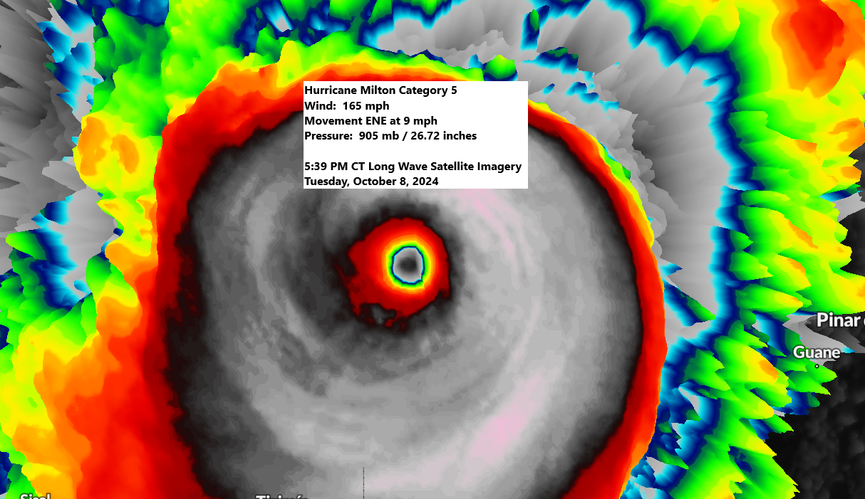
As of the 4 PM advisory from the National Hurricane Center, Hurricane Milton has escalated once again to a category 5 storm.
- Location about 475 miles southwest of Tampa Florida
- Maximum sustained winds 165 mph
- Present movement east-northeast at 9 mph
- Minimum central pressure 905 mb / 26.72 inches
Goes-16 long wave infrared loop of Milton ending 5:49 PM CT Tuesday, October 8, 2024.
Hurricane Milton is expected to reach the west coast of Florida as a major category 3 hurricane with winds of 125 to 155 mph, with landfall anticipated late Wednesday night or early Thursday morning.

Current forecasts suggest that the eye of Hurricane Milton will pass south of Tampa early Thursday morning, with an expected landfall near Siesta Key. However, the trajectory could shift as far south as Pine Island or as far north as Hernando Beach.

Hurricane Warning map

Storm Surge Warning map

Tropical Storm Warning and Watch map

The peak storm surge is expected to potentially reach 10 to 15 feet in the Tampa Bay area, extending north to the Anclote River and south to Englewood.
Peak Storm Surge Forecast

Rainfall Potential through 7 PM Friday, October 11, 2024.

Leave a Reply