6:04 PM Monday, December 16, 2024
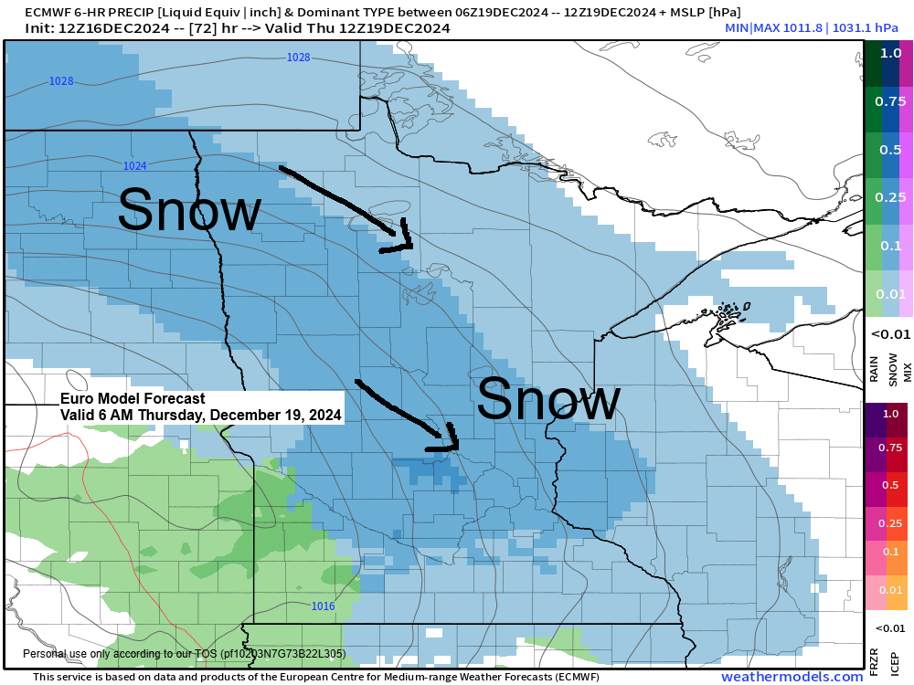
Accumulating snow remains a possibility across much of the Northland on Thursday due to a clipper low moving southeast from North Dakota.
Prior to this system, another one will traverse the Upper Midwest on Tuesday, with the majority of the snow expected to fall over southern Minnesota, but some scattered snow showers and flurries are possible over parts of northeast Minnesota and northwest Wisconsin from Tuesday into early Wednesday.
Tuesday’s wave of energy will move east out of South Dakota, passing across southern Minnesota during the day and into the early evening. Most of the lift with this system is expected to pass south of the Northland Tuesday into Tuesday evening.

RGEM model simulated radar forecast valid 6 AM Tuesday to 6 AM Wednesday.
Snow in blue

Snowfall accumulations ranging from a trace to an inch may occur in the Northland through early Wednesday morning, while southern Minnesota could see greater accumulations of 1 to 3 inches, according to the RAP model forecast.


Subscribe to continue reading
Become a paid subscriber to get access to the rest of this post and other exclusive content.