1:21 PM Thursday, December 19, 2024
Snowfall totals of about 3 to 5 inches have been reported with today’s clipper system over parts of central and eastern North Dakota, far northwest Minnesota, and in parts of central and southern Minnesota.
Lesser amounts of snow, ranging from half an inch to approximately 2 inches, have been reported further north in parts of our area so far today. These lower snow totals are due to the system tracking slightly further south than forecasted and the presence of drier air over our region.


Note: Snow is expected to persist in Duluth this afternoon and into the evening, with the snowfall ending late tonight around Midnight-2 AM.
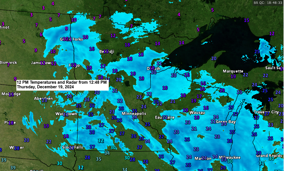
Snow (blue) continues across much of the region this afternoon.
Radar loop ends 12:52 PM Thursday, December 19, 2024.
Here’s what I have for additional snowfall amounts through late tonight/early Friday morning.
Duluth area: 1 to 3 inches of snow is possible by late tonight, but I have my doubts will see much more than 2 inches out of this event.

Low pressure was over far southern Minnesota early this afternoon and this low will continue to track toward the southeast reaching eastern Iowa by early this evening.

Temperatures will remain sufficiently cold (around -10 to -14C at 850mb) for some lake effect/enhanced snowfall for the rest of today and into tonight. This lake snow potential will affect parts of the North Shore and Duluth area through early this evening, then shift to the South Shore tonight as winds become north to northwest.

Thanks for reading!
Leave a Reply