4:50 PM Sunday, January 5, 2025
A widespread winter storm continues today from the central Plains to the Ohio Valley, spreading into the Mid-Atlantic.
Some of the highest snow totals so far have been reported west of Kansas City, with 16 inches of snow reported in Chapman, KS, and 12 inches in the Topeka, KS area. Elsewhere, numerous reports indicate snow accumulations ranging from 2 to 5 inches thus far.

Numerous winter weather alerts persist over a vast region extending from the southern and central Plains to the Ohio Valley and Mid-Atlantic.
Note – Cold Weather Advisories for wind chill temperatures in the teens and 20s extend as far south as parts of Texas and Louisiana Monday morning.

Here’s what the HRRR model is forecasting for additional snow totals through early Monday evening.

In the warmer air south of the surface low, there is a threat of severe thunderstorms and tornadoes through this evening, with tornado watches in effect for parts of Texas, Louisiana, Arkansas, and Mississippi.

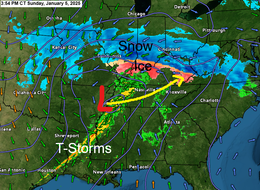
Snow – blue
Sleet/freezing rain – Orange and pink
Rain – green
Tornado warnings (red outlined areas)
Severe Thunderstorm Warnings (yellow outlined areas)
Radar loop ends 3:40 PM CT Sunday, January 5, 2025.
A strong storm moving east across the Midwest today.
Goes-16 infrared satellite loop ending 3:35 PM CT Sunday, January 5, 2025.

Another winter storm is likely to occur later this week in parts of the southern Plains as an upper low/trough lifts north/east out of Mexico and the Southwest U.S.

There is a possibility of heavy snowfall in the southern Plains mid to late week, affecting portions of Oklahoma, Texas, and Arkansas.


Subscribe to continue reading
Become a paid subscriber to get access to the rest of this post and other exclusive content.