6:37 PM Saturday, January 18, 2025
Forecast is verifying pretty well so far
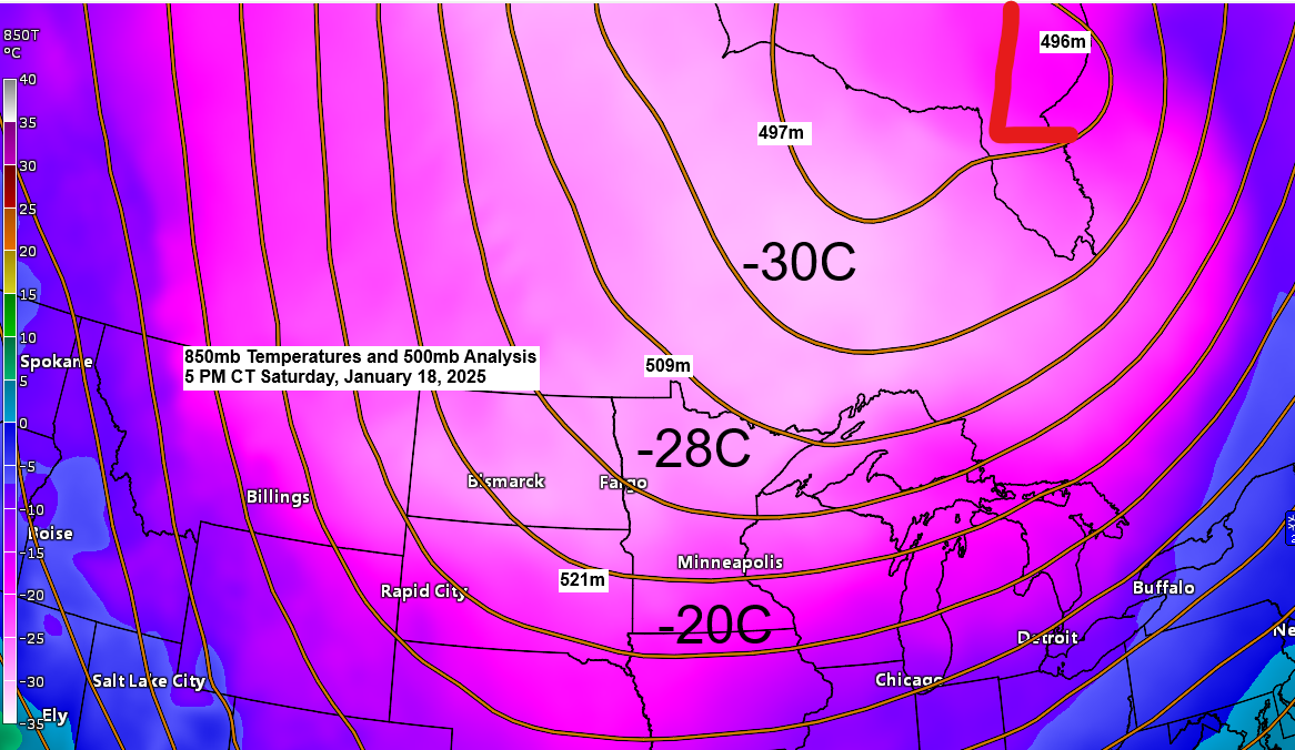
-The initial push of cold Arctic air arrived Friday night, with scattered snow showers preceding the arrival of Arctic air, while gusty winds continued through the night.
-Temperatures although cold today still weren’t too bad, although the highs for today all occurred right around Midnight — See below. Temperatures have been falling throughout the day and were generally in the single digits below to around zero this afternoon.
January 18 High Temperatures
Ashland, WI: 18 (12:29 AM)
Duluth, MN: 12 (12 AM)
Brainerd, MN: 10 (12:07 AM)
Hibbing, MN: 7 (12:22 AM)
International Falls, MN: 4 (12:06 AM)
-Core of the arctic air and coldest temperatures will settle over the Northland starting Sunday and will continue into Monday and Tuesday.
- High temperatures will range from around 5 below to 15 below zero on Sunday and Monday and around 5 below to 10 below zero on Tuesday.
- Low temperatures will range from around 15 below to 30 below zero tonight, Sunday night, and Monday night. Note: Low temperatures of 33 to 38 below zero are possible in the typical cold spots in northern Minnesota, especially Sunday night and Monday night.
Extreme Cold Warning is in effect through noon Tuesday for all of northeast Minnesota and northwest Wisconsin, with wind chills as low as 45 below zero.

In addition to the frigid temperatures, there will be dangerously cold wind chills in the next few days, as winds will continue to gust between 10 and 25 mph at times.
Wind chills from 25 below to 45 below zero are expected in the Northland tonight through Tuesday morning, with wind chills of 50 below zero possible in northern Minnesota during the next few early mornings.
HRRR model wind chill forecast through 12 PM Monday.


Subscribe to continue reading
Become a paid subscriber to get access to the rest of this post and other exclusive content.