6:26 PM Tuesday, January 21, 2025
The worst of this arctic blast is behind us.
Low Temperatures from Tuesday morning 1/21/2025
- Hibbing, MN: -35
- International Falls, MN: -30
- Duluth, MN: -27
- Brainerd, MN: -27
- Ashland, WI: -23
Note: Hibbing, Minnesota, tied its record low temperature of -35 for January 21st. This record was originally set in 1954.
Warmer air moving in
Temperatures are running roughly 5 to 15 degrees warmer in the Northland at 3 PM today compared to the same time on Monday, while in northwest Minnesota and eastern North Dakota, we’re seeing temperatures some 20 to over 30 degrees warmer at 3 PM today compared to 3 PM on Monday.

Temperatures in our area range from around zero to 5 below late this afternoon.

Warm air advection is well underway across the Northland this afternoon, with 850 mb temperatures climbing to around -16 to -20 °C.
500 mb heights are also increasing in the Northland today as the Arctic airmass moves off to the east.

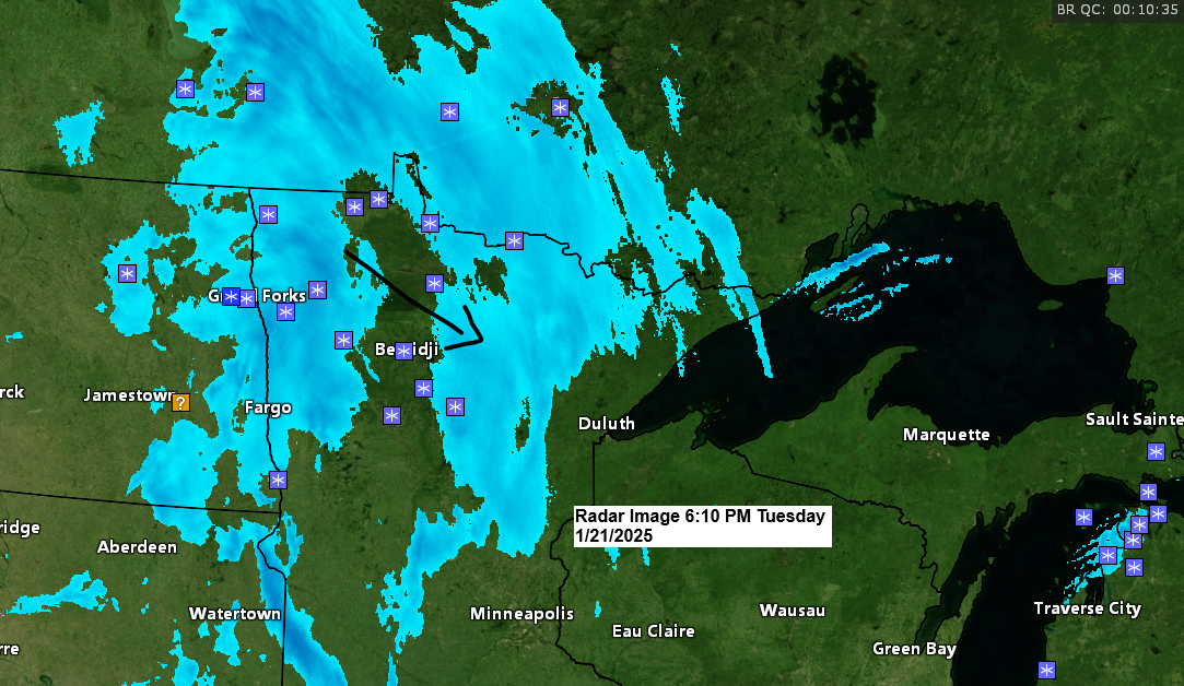
Some snow tonight
As is often the case when transitioning from arctic air to warmer air, some snow will occur tonight into Wednesday as a clipper low and cold front pass through the area.
Moisture is limited with this system, so we’re not expecting any major snow accumulations tonight, with anywhere from 0.5 to 1.5 inches of snow possible.
Note: <1 inch of snow is forecasted in Duluth tonight.
NAM 3km model simulated radar forecast through 7 PM Wednesday.

EPS (euro ensemble forecast)
Parts of northern Minnesota have the greatest chance to see over an inch of snow tonight.
Duluth’s chance of receiving 1″ or more of snow tonight is around 26%.

Above-normal temperatures are forecast for the Northland next week.

A couple more subzero nights are ahead in Duluth, although it shouldn’t be as cold as what we’ve seen the last few nights. However, as we get into next week, there’s a chance for high temperatures to reach well into the 20s, and maybe even near the freezing mark toward the middle of next week.
Note: 11 subzero nights so far this month in Duluth. Normal in January is 15 subzero nights.

The other big weather story today has been the record-breaking winter storm that affected areas from southeast Texas to parts of Louisiana, Mississippi, Alabama, Georgia, and northern Florida.
*Around 2 to 4 inches of snow in Houston, TX today.
*There’s been reports of 5 to 10 inches of snow in parts of southern Louisiana today.
*6 inches of snow (so far) around Pensacola, FL.
An extremely rare Blizzard Warning was issued this morning for parts of southeast Texas into southwest Louisiana; in fact, those areas have seen a Blizzard Warning before we’ve seen a Blizzard Warning in much of the upper Midwest.
It’s been over 600 days since the last blizzard warning was issued in much of southern Minnesota, and around 300 days in northeastern Minnesota and northwestern Wisconsin.


Subscribe to continue reading
Become a paid subscriber to get access to the rest of this post and other exclusive content.