6:23 PM Wednesday, January 22, 2025
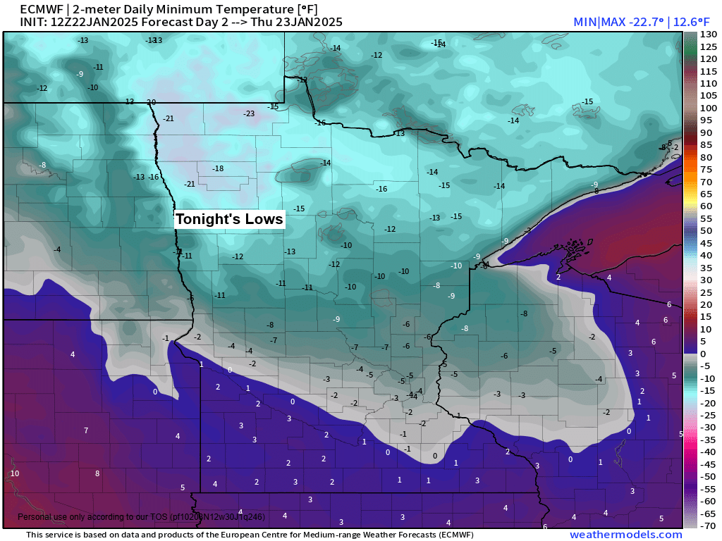
Arctic air returns to the Northland in the next few days as we will see temperatures drop to around 5 below to 15 below zero tonight and Thursday night, with 20s below possible in parts of northern Minnesota. Highs on Thursday will range from around zero to 7 above.
Northwest winds of 10 to 15 mph with gusts up to 30 mph will cause wind chill temperatures to fall to around 15 below to 30 below zero through Thursday morning.
A break from the snow tonight through Thursday night, but some more snow is expected at times on Friday and Saturday as milder temperatures return.
Areas in blue on the map are under a cold weather advisory for very cold wind chill temperatures from early to mid-morning on Thursday.

HRRR model wind chill forecast through 12 PM Thursday.

The recent Arctic blast has helped to increase the ice coverage on Lake Superior, with about 10% of the lake covered by ice. The normal amount is nearing 20% ice coverage by this time of the month.

Widespread Arctic air over the U.S. in the last few days, with average temperatures running 10 to around 25 degrees below normal in the blue and purple colors on the map.
The only areas that have had above-normal temperatures the last few days have been South Florida, parts of Maine, and parts of central/northern California.
Note: The average temperature in Duluth from January 18-21, 2025, was -11.5 degrees, which was -22.0 degrees below normal.
Daily low temperatures in Duluth during this arctic blast
1/18: -13
1/19: -22
1/20: -24
1/21: -27

Another clipper system is set to cross the Northland Friday, with some warm air advection-driven snow expected ahead of this system, and some more snow showers on Saturday as a cold front crosses the area.

Note: Snowfall accumulations ranging from 0.5 inches to 2 inches are possible in northeast Minnesota and northwest Wisconsin from Friday into early Saturday morning.
Euro model simulated radar forecast valid 12 PM Friday to 7 PM Saturday
Snow in blue

Thanks for reading!
Leave a Reply