6:31 PM Tuesday, January 28, 2025
Cold air is replacing the warm air we experienced in the Northland today as a clipper low moves east, allowing a strong cold front to push south through the area.
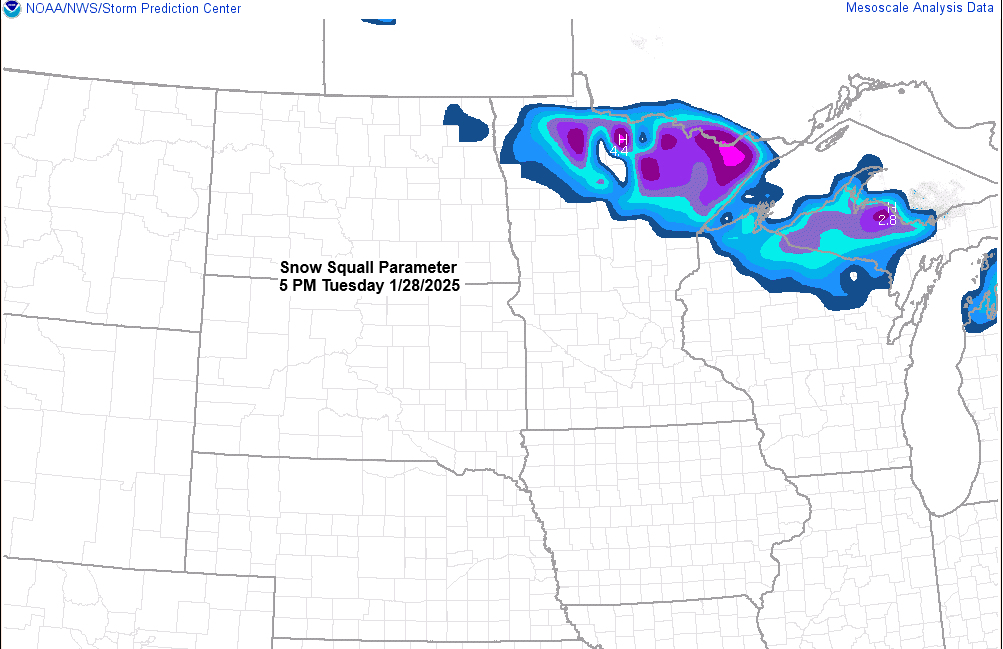
The combination of steeper lapse rates and cold air advection will increase the risk for scattered snow showers and squalls across the Northland this evening, with brief whiteout conditions possible under these squalls due to the combination of falling snow and wind gusts, which could reach 30 to 50 mph. Note: Snowfall accumulations of <1″ are expected in some parts of the area this evening.
Peak Wind Gusts from today (1/28/2025) thru 4 PM
Duluth, MN: 46 mph
Ashland, WI: 44 mph
International Falls, MN: 41 mph
Brainerd, MN: 39 mph
Hibbing, MN: 39 mph
Note: Today was the 4th straight day with wind gusts of 30 mph or more in Duluth, and the 13th day this month with gusts reaching at least 30 mph.

We’ve got quite a jet stream roaring through the northern Plains and upper Midwest today with arctic air to the north and warmer air to the south.

Today’s highs in the Northland and their departure from normal for Jan. 28
Ashland, WI: 43 (+21 degrees above normal)
Brainerd, MN: 42 (+20 degrees above normal)
Duluth, MN: 40 (+20 degrees above normal)
Hibbing, MN: 38 (+21 degrees above normal)
International Falls, MN: 36 (+20 degrees above normal)
Note: No new high temperature records were set in the Northland today, even though temperatures were around 20 degrees above normal.
The temperatures this evening vary greatly, from 10s below zero in central and eastern Canada to the 50s and 60s in the central and southern Plains.

This weekend, a low-pressure system will move east from the northern Plains, bringing some light snow to the Northland on Saturday and Sunday.
Snowfall amounts vary for the Northland this weekend, but early estimates suggest 1 to 2 inches, with higher totals possible along the North Shore due to lake-enhanced snow if there’s enough cold air.

Mid to late next week (~Feb. 5-7), there might be more snow or mixed precipitation in the Northland as a system comes in from the Rockies.
Chances are low for this system to be a major winter storm for our area unless we see the pattern amplify more than what it looks like now. Currently, this system looks progressive as it tracks east while helping to knock down the ridge, which will set up from the Midwest to the Great Lakes next week.

Thanks for reading!
Leave a Reply