6:22 PM Thursday, January 30, 2025
After a mild day, temperatures will cool down in the coming days, and some snow is expected this weekend.
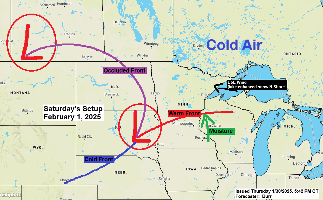
- A Winter Storm Watch is in effect from Saturday afternoon through late Saturday night for the North Shore of Lake Superior, including the cities of Two Harbors, Silver Bay, Lutsen, and Grand Marais.


-Some light snow and flurries are possible in parts of the Northland on Saturday with some heavier snow developing later Saturday afternoon and continuing into Saturday night.
-East winds crossing Lake Superior with enough cold air in place should lead to some lake enhancement in the snowfall Saturday afternoon/night along the North Shore of Lake Superior.
-Only about 7% of Lake Superior is covered by ice, leaving lots of open water for lake-enhanced snow along the North Shore this weekend.
-East winds of 15 to 25 mph along the North Shore of Lake Superior may cause some blowing snow Saturday night.
-Snow will stop from west to east Sunday morning.
European model simulated radar forecast valid 6 AM Saturday to 12 PM Sunday.

Today’s highs in the Northland and the record highs for January 30th
Brainerd, MN: 48 (old record high 45 set in 1989)
Ashland, WI: 45 (record high 47 set in 2016)
Duluth, MN: 43 (record high 44 set in 1890)
International Falls, MN: 39 (record high 43 set in 1999)
Hibbing, MN: 39 (record high 42 set in 1989)
What a day! Most of Minnesota and Wisconsin saw temperatures in the 40s and 50s, with some places along I90 in southern Minnesota reaching close to 60 degrees this afternoon.

Temperatures this afternoon were running about 25 degrees above normal in northeastern Minnesota and northwestern Wisconsin, to as much as 30 to 35 degrees above normal in southern Minnesota, southern Wisconsin, and northern Iowa.

My snowfall forecast and some additional info about the weekend system found below.

Subscribe to continue reading
Become a paid subscriber to get access to the rest of this post and other exclusive content.