3:55 PM Sunday, February 9, 2025
-We’re changing from a snowy pattern to a colder, drier one for the next several days.
-Plenty of Arctic air ahead, with dangerously cold wind chills at times during the night and morning hours.
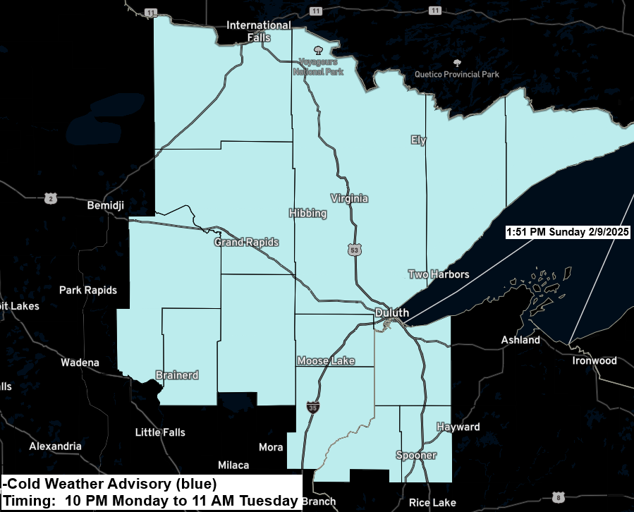
-Cold weather advisory is in effect for all of northeast Minnesota and far northwest Wisconsin from late Monday evening through late Tuesday morning. Wind chill temperatures as low as 35 below to 40 below zero are expected.
- 5 subzero nights in Duluth so far this month; February’s average is 11.
- 25 subzero nights so far this winter in Duluth. The average for the winter season (DJF) is 35 subzero nights.
Low Temperature Reports from Sunday morning, February 9, 2025
International Falls, MN: -18
Hibbing, MN: -18
Grand Rapids, MN: -14
Hayward, WI: -14
Walker, MN: -13
Brainerd, MN: -13
Hinckley, MN: -13
Duluth Airport: -8
Duluth Sky Harbor Airport: -7
Superior Airport: -7
Ely, MN: -7
The coldest nights this week will be from Monday to Thursday, with lows in the teens, 20s, and some spots even hitting 30 degrees below zero in the Northland.
Below is the low temperature forecast for Tuesday morning.

HRRR model wind chill forecast valid 6 PM Monday to 10 AM Tuesday.

The arctic air is coming from the northwest, with temperatures at 850mb reaching -32C. This cold air will move southeast into the Northland in the coming days.

Temperatures in central and northern Canada were mostly below zero, in the single digits, teens, and 20s this afternoon.

Two systems will pass well to the south of the Northland this week, bringing some snow to far southern Minnesota and southern Wisconsin. The first system is on Monday, and the second system is around Wednesday to early Thursday.

A third system later this week could track far enough to the north to bring some snow to parts of the Northland between Friday and Saturday, but this doesn’t look like it will be a major snow event at this time.
Shown below are the Euro ensemble (EPS) model probabilities for greater than 1 inch of snowfall for the 24-hour period ending at 12 PM Saturday.

Thanks for reading!
Leave a Reply