6:50 PM Wednesday, February 26, 2025
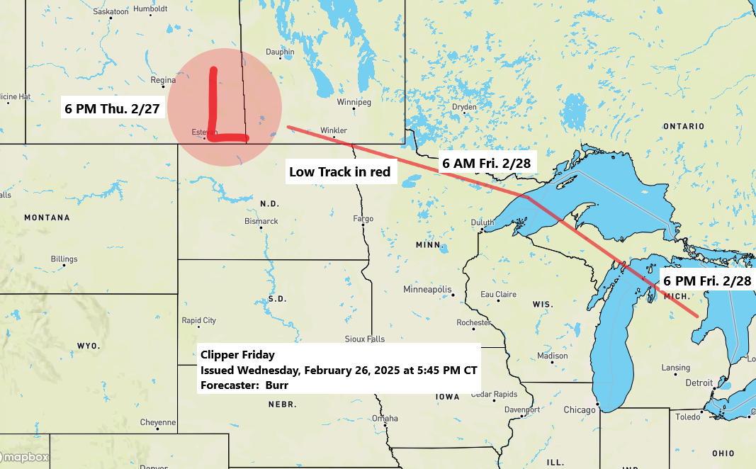
A potent clipper low is forecast to move east-southeast out of eastern Saskatchewan on Thursday evening. This low-pressure system is expected to track across far northern Minnesota around dawn on Friday before shifting more southeastward, reaching northern areas of lower Michigan by early Friday evening.
Most of the Northland won’t see much snow out of Friday’s system due to an unfavorable storm track, the exception being in far northeast Minnesota closer to the low where waves of moderate to heavy snow are expected on Friday.
Wind will be an issue, particularly to the west and south of the low-pressure track. Wind gusts of 20 to 40 mph or greater are possible on Friday in parts of the Northland, including the Duluth metro area.
Snowfall rates of up to 1″/hour are possible for a few hours Friday morning in far northeastern Minnesota.

Here’s my snowfall forecast for Friday ending Midnight Friday night.

A strong temperature gradient will setup associated with Friday’s clipper system with temperatures early Friday morning ranging from the 30s and 40s over much of Minnesota except in the Arrowhead where will have temperatures in the 20s, while north of Lake Superior subzero temperatures are expected.

NAM 3km model simulated radar forecast valid 9 PM Thursday to 6 PM Friday.

Weak System Tonight
Another fast-moving disturbance will drop southeast across the area tonight, bringing some snow showers or mixed precipitation to parts of the Northland.
NAM 3km model simulated radar forecast through 7 AM Thursday.

A plume of steep lapse rates of around 7.0 °C/km is forecast to spread southeast across the Northland tonight, which could lead to some brief heavier snow showers in some parts of the area tonight.
Note: Snowfall accumulations of a trace to an inch are possible in some areas of the Northland tonight.

System Next Week
Significant differences remain in the forecast models regarding a system for early to mid-next week.
- Computer models seem to be struggling to determine the extent of phasing between two systems, one embedded within the northern branch of the jet stream and the other within the southern branch.
- The piece of energy associated with the southern branch is expected to be the stronger of the two, as low pressure moves east-northeast from the southern and central Plains to the Midwest and eastern Lakes region by Wednesday of next week.
- The trajectory of the low-pressure system over the central Plains remains highly uncertain. However, if it moves far enough north, certain areas of the Northland may experience a more significant precipitation event around next Tuesday-Wednesday.
- A significant amount of cold air appears to be absent with this system for next week, so even if precipitation occurs in the Northland, it is likely to fall as rain or a rain-to-wet-snow type of scenario.
Displayed below is an ensemble model blended forecast for the track of next week’s system, utilizing the Euro Ensemble, GEFS, Canadian, and UK models.
Stay tuned for updates

Thanks for reading!
Leave a Reply