5:56 PM Thursday, March 6, 2025
We have one more chance of snow late Friday night or Saturday morning, followed by warmer weather this weekend and early next week, with highs Sunday and Monday in the 40s and 50s in the Northland, and 60s, with even a few 70s possible in western/southern Minnesota. However, another big system may be coming later next week.
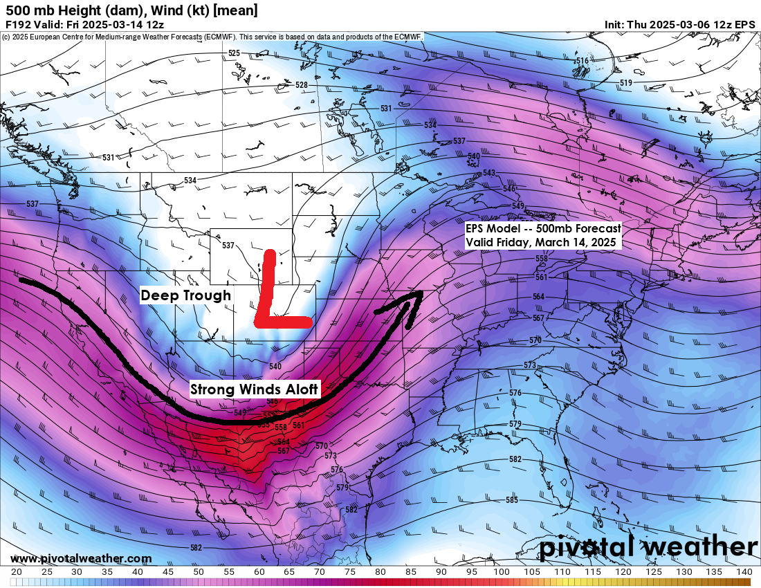
The upper-level pattern that the computer models indicate for late next week is favorable for a system to emerge from the Rockies, but the storm track and intensity are far from certain as this is still about a week out. Additionally, the type of precipitation we anticipate is also uncertain right now. There’s a chance this system will produce mostly rain in the Northland, a rain-to-snow scenario, or mostly all snow. Wind could also be an issue next Friday-Saturday, based on the current outlook. Stay tuned.
Currently, the computer models predict a warmer system late next week, raising concerns about whether it will bring significant snow to our area.

A southern track shown in blue might bring more snow than rain to the Northland late next week, while a western track shown in purple could lead to more rain than snow.
Based on what the computer models are showing in terms of temperatures today, a more westerly track is preferred at the moment.

A clipper system is expected to move southeast through the Northland, bringing a few hours of snow on Saturday morning, with possible accumulations of 0.5 to 1.5 inches.
NAM 3km model simulated radar forecast valid 1 AM Saturday to 1 PM Saturday.

Make a one-time donation
Make a monthly donation
Make a yearly donation
Choose an amount
Or enter a custom amount
Your contribution is appreciated.
Your contribution is appreciated.
Your contribution is appreciated.
DonateDonate monthlyDonate yearlyThanks for reading!
Leave a Reply