6:30 PM Sunday, March 16, 2025
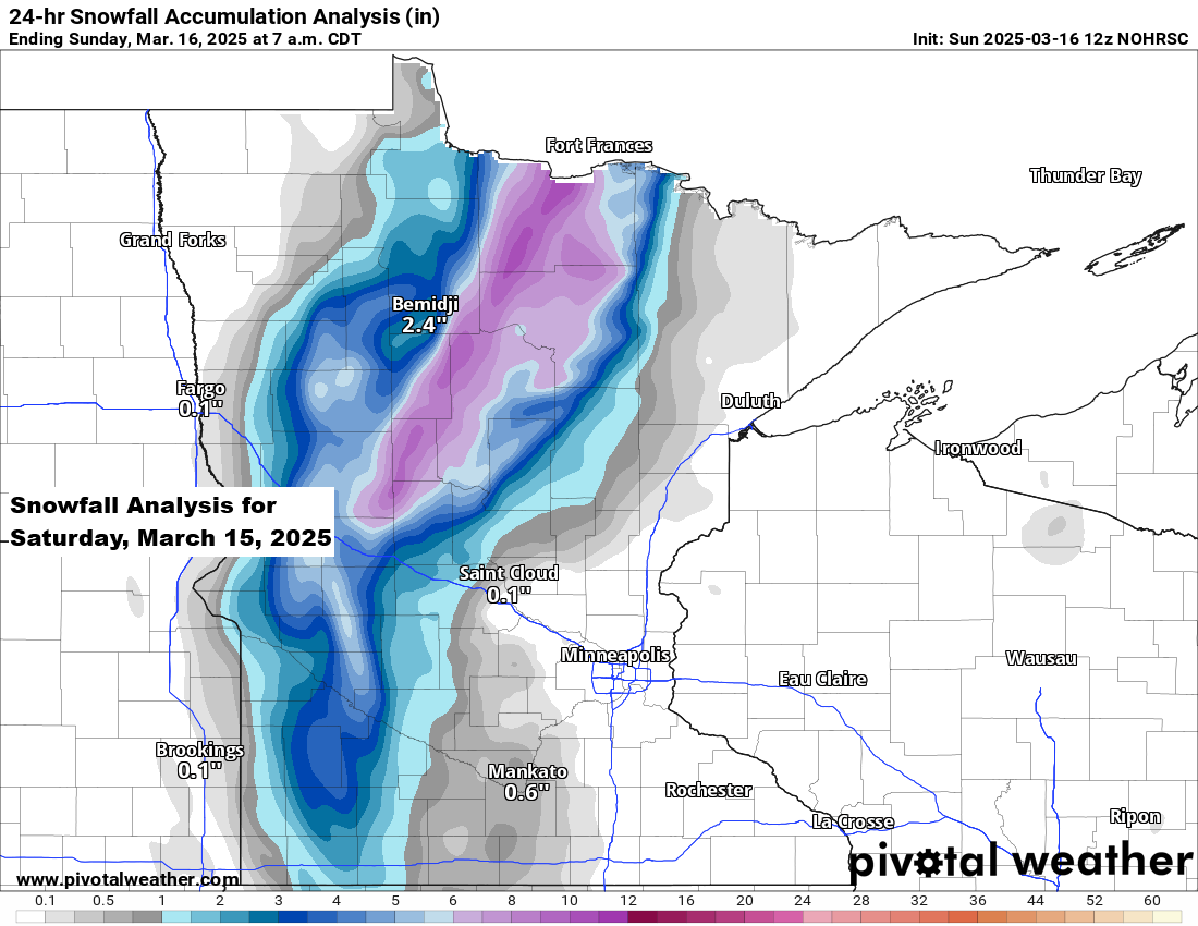
A small portion in the northwest part of the area saw a significant amount of snow on Saturday, with accumulations of 5 to 8 inches and lesser amounts of snow farther to the south and east.
Northland Snowfall Reports from March 15, 2025
8 ESE Northome, MN: 8.4″
7 WNW Hackensack, MN: 7.8″
1 N Oshawa, MN: 7.0″
6 ENE Walker, MN: 7.0″
1 NE Backus, MN: 7.0″
2 SSE Brevik, MN: 6.8″
2 ENE Max, MN: 5.0″
Federal Dam, MN: 5.0″
5 NE Brainerd, MN: 2.8″
1 SW Crosby, MN: 2.7″
4 ENE Zemple, MN: 2.3″
8 ESE Brainerd, MN: 2.0″
3 NNE Nisswa, MN: 1.8″
3 E Orr, MN: 1.3″
Cook, MN: 1.2″
Coleraine, MN: 1.2″
2 ENE Baxter, MN: 1.2″
1 NW International Falls, MN: 1.1″
12 N Grand Rapids, MN: 1.0″
Here’s the evolution of my snowfall forecasts for Saturday’s storm.
Initial forecast was issued on Tuesday, March 11th.

Updated snowfall forecast on Thursday, March 13th.

Final forecast for this event was issued on Friday, March 14th.

Storm Track Forecasts with an initial forecast made on March 9th.


Thanks for reading!
Leave a Reply