6:02 PM Sunday, March 16, 2025
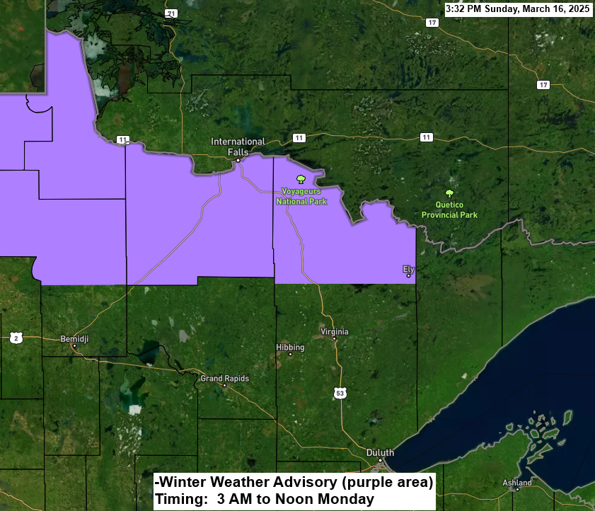
Heads up in far northern Minnesota, more snow is coming Monday morning with a winter weather advisory for International Falls, Littlefork, Orr and Crane Lake.
The snow Monday morning should stay north of Duluth, and another system around Wednesday looks to pass south of Duluth. So, we’ve been pretty lucky (or unlucky depending on how you look at it) this month and really the entire winter, as a lot of these larger systems have missed the Twin Ports area.
44 inches of snow have fallen so far this season in Duluth, which is 31 inches below average. As of March 16th, the snowfall is at 59% of normal. Interestingly, this winter has about 25 inches more snow than last winter.
Here’s my snowfall forecast for Monday morning; again, this will be a far northern Minnesota snow event.

NAM 3km model simulated radar forecast valid 1 AM tonight to 4 PM Monday.

Minnesota will experience a big temperature difference on Monday, with temperatures ranging from the 30s in the far north to the 60s and low 70s in the south.

Midweek Winter Storm Potential
A stronger system is forecast to move across the Rockies and onto the central Plains during the middle of the week, and this system could bring some heavy snow and strong winds to parts of the upper Midwest on Wednesday, with blizzard or near-blizzard conditions possible due to the wind and falling snow, which could cause considerable blowing snow and potential whiteout conditions.

Currently, it doesn’t look like the upper-level pattern will amplify enough to force this storm on a more northerly track, which would increase the chance for a significant winter storm in Duluth, as well as in east-central Minnesota and northwest Wisconsin Tuesday into Wednesday.
The pattern favors a flatter storm track or more of an east-northeast track for the low, which would keep the heaviest snow accumulations south of the Northland Tuesday night and Wednesday.
There still could be a little snow, however, in the area Tuesday to early Wednesday, but accumulations look pretty minimal at this time.
Stay tuned for updates

Thanks for reading!
Leave a Reply