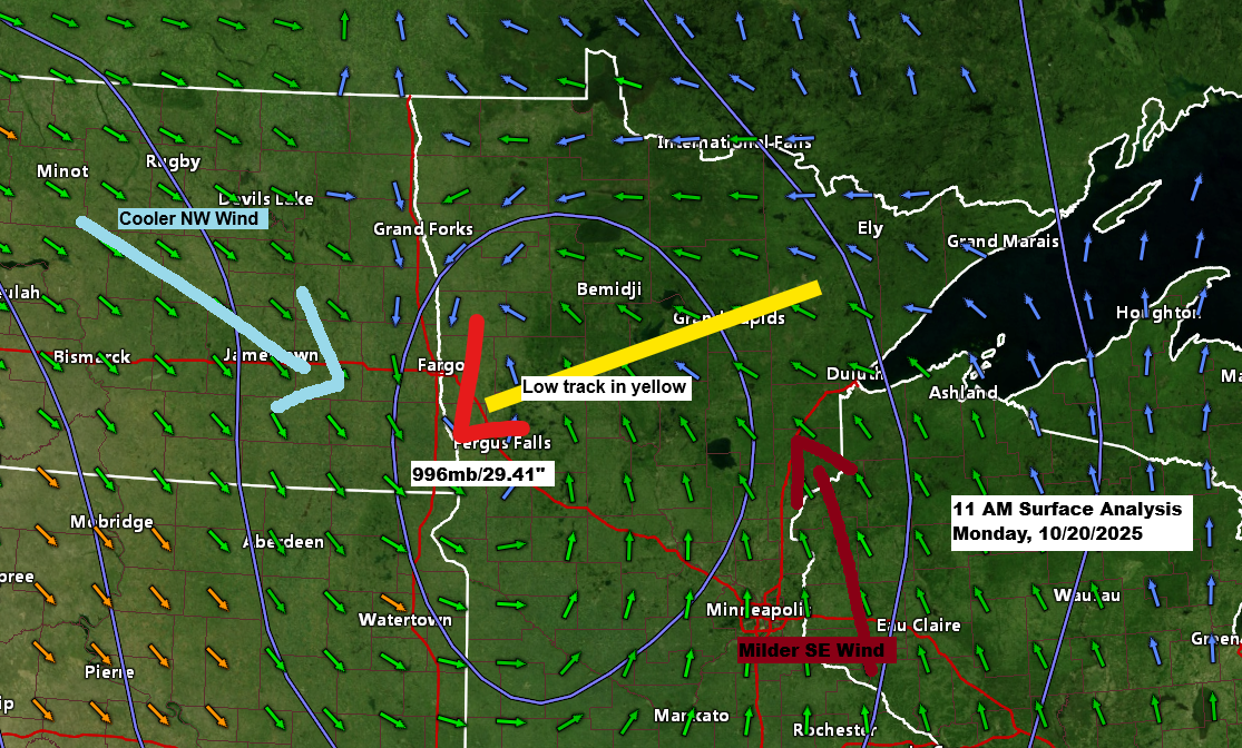
Late this morning, a low-pressure system averaging 996mb (29.41 inches) was centered near Fergus Falls in western Minnesota. This system is expected to move northeast throughout the day, passing near or just northwest of Duluth by early evening.
At the moment, northeast Minnesota and northwest Wisconsin sit in the warm air advection part of this system, but that will change to cold air advection by tonight as we get on the backside of this system.

The mid and upper-level trough associated with this system is quite strong, with 12-hour 500mb height falls ranging from -90 to -120 meters across much of the northern Plains this morning. This trough is expected to continue digging south and east into the upper Midwest through tonight.

Most of today’s rain has been concentrated over eastern North Dakota, stretching into far northwest and northern Minnesota. However, a band of showers is moving quickly northeast across central Minnesota late this morning, and this area of rain is expected to impact Duluth this afternoon between 2 PM and 5 PM.
Radar loop ends 11:20 AM Monday, October 20, 2025.
Rainfall across most of the Northland is expected to stay light through midnight, with totals around 0.05 inches or less for Duluth and much of northwest Wisconsin. Slightly higher amounts of 0.1 to 0.25 inches are anticipated in far northern Minnesota and the Arrowhead region.

Soil moisture levels as of October 19th, 2025, are on the dry side in much of northeast Minnesota and northwest Wisconsin, especially in the red and orange colors on the map below. The areas with the driest soils are unlikely to receive much rain this week.

Leave a Reply