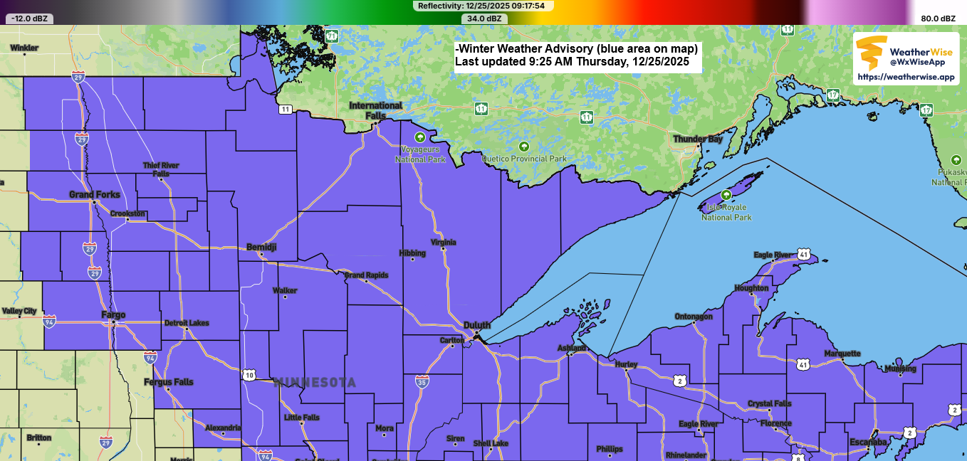
Freezing rain and sleet are expected to move across parts of northeast Minnesota and northwest Wisconsin tonight, creating icy roads and making travel slippery.
Also of note will be areas of fog that are expected over parts of the Northland tonight and Friday morning, and possibly again Friday night into Saturday.
In Duluth, temperatures will stay fairly steady tonight, ranging from 27 to 31 degrees, before rising to between 33 and 36 degrees by Friday afternoon. Icy roads tonight should improve as the warmer afternoon temperatures climb above freezing.
Tonight, parts of northeast and east central Minnesota and northwest Wisconsin can expect ice accumulations from a light glaze up to about 0.10 inches, with a few spots potentially reaching 0.20 inches if heavier showers develop.
Note: Damage to trees and power lines, along with power outages, isn’t expected in the Northland tonight, as ice accumulations shouldn’t be significant enough to cause those kinds of impacts.


Here’s my updated snowfall forecast ending 6 AM Friday.
Duluth area: Less than 1″ of snow.

Radar loop ends 8:20 PM Thursday, December 25, 2025.
Freezing rain and sleet (pink), rain (green), and snow (white and blue) will keep moving east-northeast across the Northland tonight, with the precipitation tapering off early Friday morning.
The reason why we’re seeing this freezing rain and sleet tonight is due to a layer of warmer air aloft which shows up in the 700 and 850mb analysis this evening.
With 700mb temperatures between 0 and +1°C, there’s a higher likelihood of freezing rain or sleet tonight, while the colder air over the Arrowhead (-3°C at 700mb) should keep most of the precipitation as snow, with a chance of some sleet.

The 850mb temperatures reveal a warm layer of +2 to +3°C in parts of the Northland, which will melt snow tonight and increase the likelihood of freezing rain or sleet.

Another chance for rain and snow arrives this weekend along with a drop in temperatures and strong northwest winds on Sunday.
There’s definitely a slowing trend with the 500mb trough on the Euro model for Sunday, which could boost the chances for a few inches of snow in parts of the Northland from Sunday into Sunday night. However, the system doesn’t seem likely to fully phase, which will keep snowfall amounts limited late in the weekend.

Precipitation is almost certain to start as some rain in the Northland Saturday through Sunday morning as temperatures look to be in the 30s, but these temperatures will drop quickly from west to east Sunday afternoon as northwest winds increase with gusts of 20 to 30 mph or stronger.


Leave a Reply