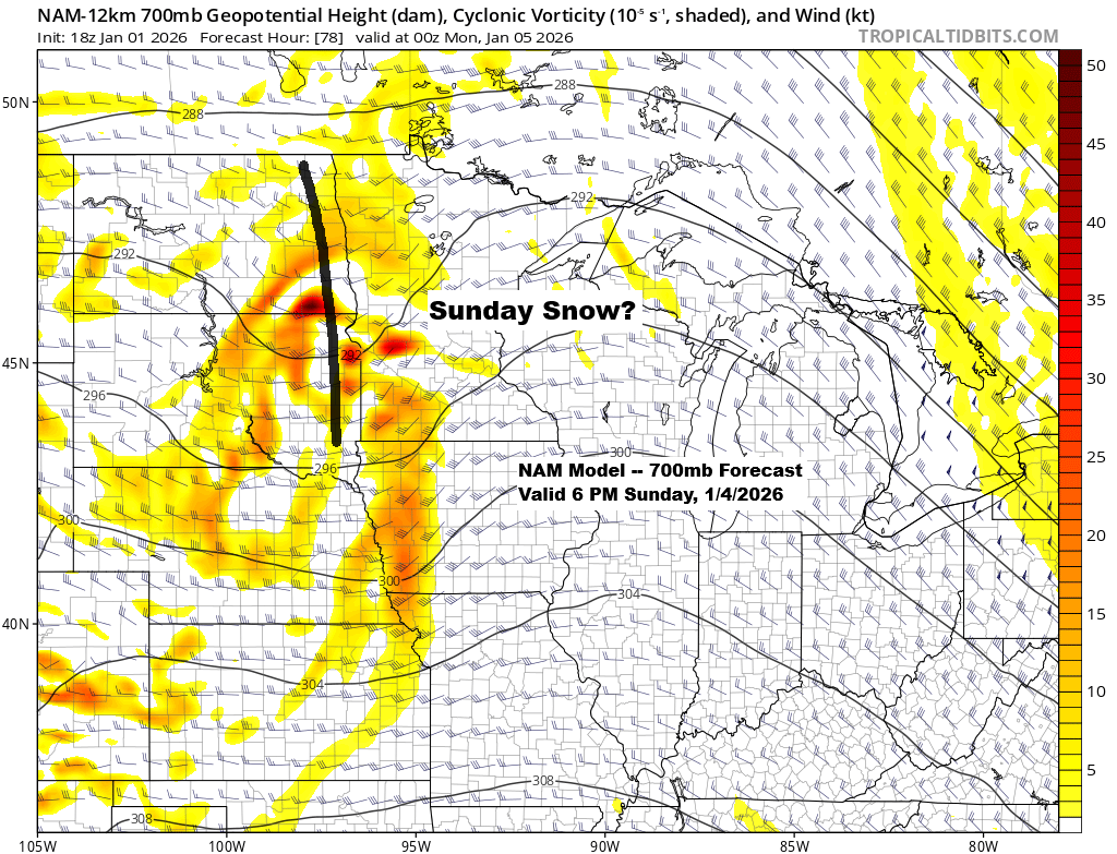
As I mentioned in my Wednesday post, there’s still a chance of a couple of inches of snow in the Northland on Sunday, and today’s model runs continue to back that up.
Sunday’s system won’t be a major winter storm, more of a clipper-type setup, but the associated trough looks pretty strong, which should add some lift. There also appears to be enough moisture for precipitation, and current temperatures from the surface to aloft look cold enough for snow to be the main type, though some mixed precipitation is possible, especially in east central Minnesota and northwest Wisconsin. Timing looks to be from mid-to-late afternoon Sunday through Sunday night, with everything moving east by early Monday morning.
Before Sunday’s system arrives, quieter weather is expected for northeast Minnesota and northwest Wisconsin, though the cold will stick around. Lows will dip into the single digits and teens below zero tonight, with highs in the single digits to low teens above zero on Friday. A few snow showers may linger this evening, and some light snow could fall in spots Saturday, but totals should stay under an inch.
Note: Today’s clipper dropped 0.6 inches of light, fluffy snow on Duluth, boasting an incredible snow-to-liquid ratio of 60:1. Just 0.01 inches of melted precipitation fluffed up into 0.6 inches of snow—mostly air, with hardly any water.
In the last three days, Duluth has gotten 2.3 inches of snow but only 0.07 inches of precipitation, giving an impressive snow-to-liquid ratio of about 33:1. The snow lately has been pretty dry, with hardly any water in it.
…Next week’s temperature trends…
The GEFS model has aligned with the EPS model, forecasting a stretch of above-average temperatures in northeast Minnesota and northwest Wisconsin for January 4-9. It looks like there will be a welcome break from the subzero temperatures next week.
On the maps below, orange and red show above-average temperatures, while blue represents below-average temperatures.


Leave a Reply