Chilly weather made its way back to the Northland today.
Today’s highest temperatures hit just after midnight, when it was in the 30s, but they’ve been dropping ever since. By 5 PM, it was about 15 to nearly 30 degrees colder than the same time on Thursday.
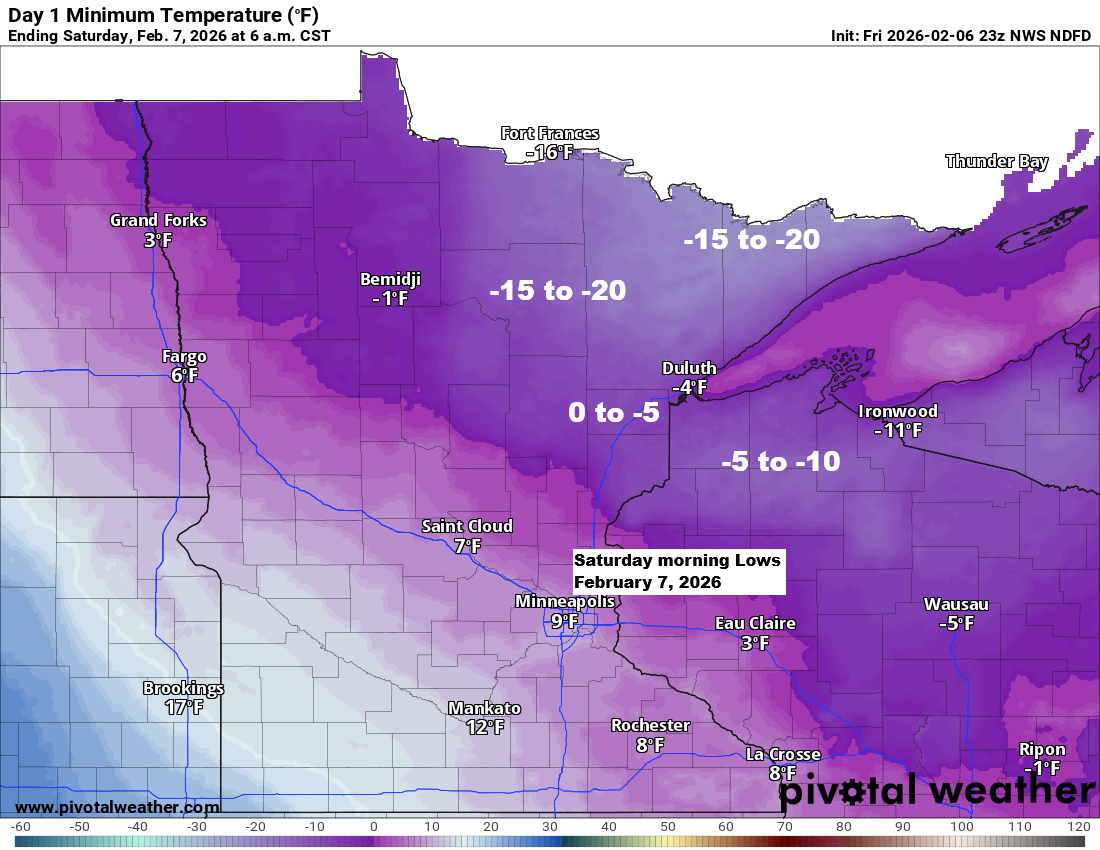
Subzero temperatures, ranging from about 5 to 20 degrees below zero, will return to much of the Northland tonight, but this should be the last night of such extreme cold for a while.
This weekend’s coldest air will mostly slide east of the Northland, giving us just a brief brush with arctic chill. Tonight will be the coldest point, with temperatures starting to warm up afterward.


A couple of weak systems might bring a light dusting of snow to far northeast Minnesota this weekend—one late Saturday night and the other Sunday night. Neither seems particularly impressive.

Looking ahead, the ensemble models still suggest a more active pattern, though the timing now appears to be later than it seemed over the past few days.
Overall, no major storm systems are expected to impact the Northland next week, but the week of February 15th could bring a different scenario. However, since it’s still far out in the forecast, things could easily change. Even if the pattern does become more active, there’s no guarantee of snow—it could just as easily be rain or a mix. Stay tuned.
If most of the precipitation falls as snow, we could see some impressive totals, with liquid amounts between about half an inch and an inch predicted by the ensemble models over the next couple of weeks.


Leave a Reply