This afternoon, temperatures warmed into the 70s as far north as Nebraska and western Iowa, while the 50s reached into southwestern Minnesota, including towns like Luverne, Jackson, and Worthington.
Temperatures were cooler in northeast Minnesota and northwest Wisconsin today compared to areas farther south, but even here we reached the mid-30s to around 40 degrees, which is well above average for mid-February.

The red icons on the map mark locations that have reached a new record high temperature for today, February 9, 2026, as of 3 PM CT.

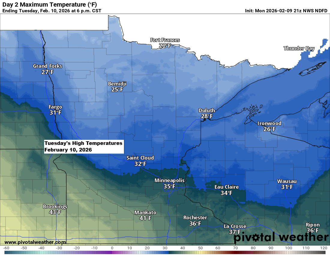
Note: Slightly cooler temperatures will move in on Tuesday and stick around through Wednesday, with highs mostly in the 20s to around 30 across northeast Minnesota and northwest Wisconsin. By later this week and into the weekend, the Northland should see a return to highs in the 30s and 40s.
Northwest winds will pick up late tonight into Tuesday, with gusts of 15 to 30 mph sweeping across the Northland.
It’s no surprise that some of the warmest temperatures in Minnesota today were in the southwest corner, where there’s little to no snow covering the ground.


Hardly any snow is expected for the rest of this week in northeast Minnesota and northwest Wisconsin.
Of the 20 GEFS ensemble members, not one is predicting more than a trace of snow for Duluth through next Monday, February 16, 2026.
If the pattern changes, it likely won’t happen until sometime next week, and in the world of weather models, that’s pretty much in the realm of fantasy.
Note: To hit our average annual snowfall in Duluth of 90.2 inches, we’d need another 50.4 inches between now and April. I’d say the odds are pretty low—not impossible, but slim—especially given how dry this winter has been so far.
By February 8th, this winter has only seen about 5 more inches of snow than last winter in Duluth. It seems we might be headed for our third straight winter with well below average snowfall.

A weak system is showing some radar echoes today, but most of it isn’t reaching the ground, aside from a few isolated spots of drizzle this afternoon.
There might still be some light rain or a mix of rain and snow this evening, mainly in parts of east-central Minnesota and northern Wisconsin, but whatever falls should be very light.
Radar loop ends 4:06 PM Monday, February 9, 2026.
Leave a Reply