Our next snow event to impact the Northland comes in the form of a clipper system, which is something we’ve seen a lot of this winter.
The majority of the snow from this clipper will fall late tonight until early Tuesday afternoon, tapering off from northwest to southeast.
…Here’s the setup…
Arctic airmass which was over the Northland Sunday is retreating off to the east today, making way for a clipper low approaching from the northwest. A shot of warm air advection ahead of this low will help to produce some snow in the Northland late tonight through early Tuesday afternoon.

Euro model simulated radar forecast through 6 PM Tuesday.

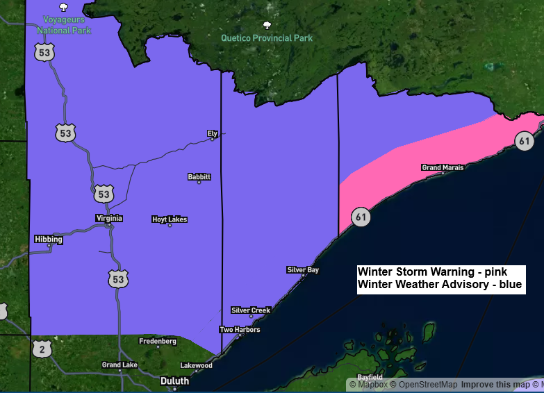
…Snowfall Forecast…
Areas north of Duluth and across the Bayfield Peninsula in far northern Wisconsin are looking at about 1 to 3 inches of snow by Tuesday afternoon, with higher totals of 3 to 6 inches possible from Tofte and Grand Marais up to Hovland. The rest of the region, including Duluth, should see up to an inch of snow from this system.

…Temperature Trends this Week…
We’re in for a roller‑coaster temperature pattern this week. Today’s cold sticks around only briefly, with milder air returning Tuesday. Another dip arrives Wednesday before a stronger warming trend takes over late in the week. Friday currently looks like the warmest day, with highs well into the 30s and 40s across northeast Minnesota and northwest Wisconsin, and even some 50s possible over southern Minnesota. This late‑week warmth won’t last long, though—another shot of Arctic air is set to arrive for the weekend, bringing a return to subzero temperatures across the Northland.

Leave a Reply