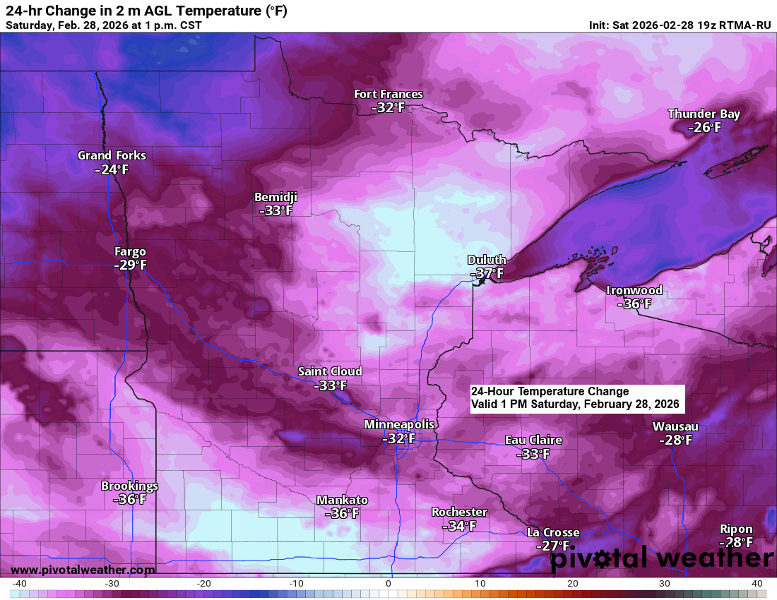
That was quite a cold front that blasted through the region on Friday. In its wake, temperatures early this afternoon were running about 30 to 35 degrees colder than they were early Friday afternoon.
Low temperatures this morning dropped as low as the teens below zero in far northern Minnesota, with single digits above and below zero readings elsewhere in the Northland.

Lows Sunday morning in northeast Minnesota and northwest Wisconsin are forecast to range from around 5 above to as low as 25 below zero.

…Long Range Trends…
The weather pattern stays relatively quiet in the Northland for the next several days, but the longer range continues to look more active, with a few systems possibly taking aim at the Northland after March 5th.
Precipitation totals of around an inch to over an inch are possible in northeastern Minnesota and northwestern Wisconsin per ensemble model guidance (EPS, GEFS, and CMCE) through March 15th.
Note: Whether this precipitation falls mostly as snow, rain, a wintry mix, or a little of all three remains uncertain at this time. But if we see mostly snow or a wintry mix, then we could be seeing significant accumulations of either snow or ice.


Leave a Reply