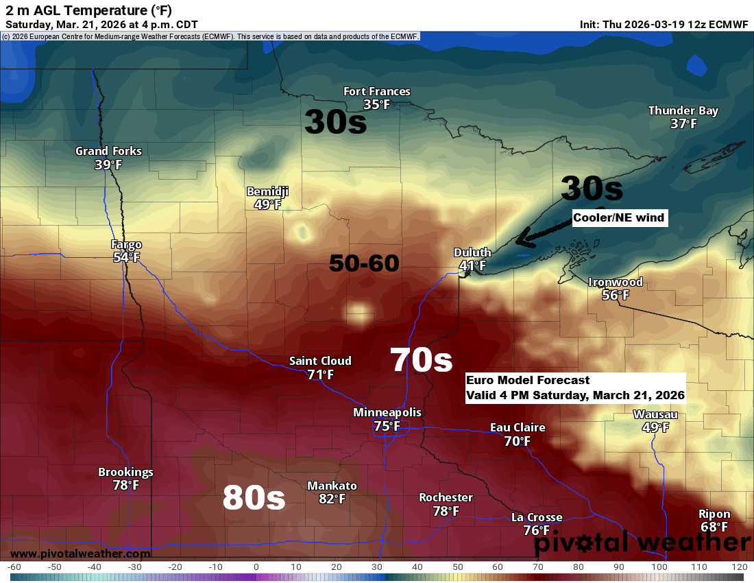
Mild temperatures will stick around for the next few days, with Saturday shaping up to be the warmest. Highs could reach the low 80s in far southern Minnesota, with 70s possibly extending as far north as Pine City, Hinckley and Grantsburg.
Northeast Minnesota and northwest Wisconsin will see 50s and 60s on Saturday, but true to early spring, cooler lake breezes are expected. On Saturday, those breezes will keep temperatures in the 30s and 40s near Lake Superior, including Duluth.
Sunday is looking colder, with temperatures likely barely climbing out of the 20s across much of the Northland.
A significant heat wave is sweeping across much of the western U.S., stretching east into the central and southern Plains today, with temperatures hitting the 80s and 90s, and even reaching the 100s in parts of Arizona and southern California this afternoon. The 500mb heights under the ridge have climbed to 595 decameters, which is quite remarkable for March.

The very warm temperatures have spread northeast into parts of the northern Plains today, with temperatures in the 70s in much of the Dakotas and 80s in South Dakota. Low 70s even made it to southwest Minnesota this afternoon.
Today, temperatures in the northeast of Minnesota and northwest of Wisconsin were in the cooler 40s and 50s, while areas near Lake Superior saw chillier readings in the upper 20s and 30s.

…Weekend Precipitation Chances…
Northeast Minnesota and northwest Wisconsin could see rain, snow, and a wintry mix from Saturday night into Sunday as a frontal boundary sags south through the region.

If we get any precipitation this weekend, it doesn’t seem like it will amount to much, with just a light glaze of ice possible on Saturday night.

Snowfall could reach 1 to 2 inches from Saturday night into Sunday in parts of northeast Minnesota, with generally less than an inch expected elsewhere, including Duluth.

Leave a Reply