Snow will continue in the Northland this evening on the backside of the mid and upper-level low, but it will taper off from west to east later tonight as the system moves away. With the strong April sun angle fading late this afternoon, we could see some slushy accumulation on roads, with additional snow amounts ranging from about 0.5 to 3 inches, highest in northern Minnesota and in the Arrowhead.
The Duluth area might get up to an inch of additional snow this evening.
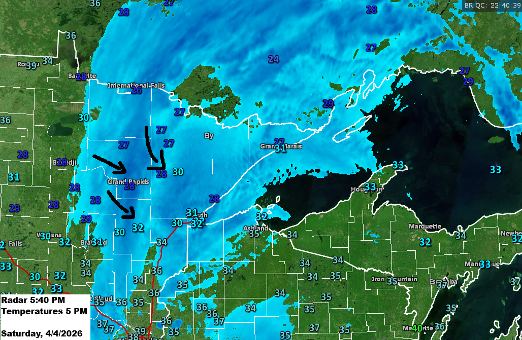
Note: By 4 PM today, Duluth, Minnesota (National Weather Service location) had received 1.5 inches of snow. We might see a bit more accumulation this evening, but it’s unlikely to reach the 3–5 inches I had originally forecast for this system.
Tonight, temperatures will dip into the 20s, with some spots possibly hitting the teens, making overnight refreezing likely. By Sunday, things will warm up a bit, with highs in the mid-30s to low 40s across the Northland. For reference, the average high in Duluth on April 5th is 44 degrees.
…Today’s system…
A strong early April low-pressure system swept through the upper Midwest today, bringing a messy mix of precipitation to northeast Minnesota and northwest Wisconsin.
This morning, parts of northwest Wisconsin saw freezing rain that left significant ice, while northeast Minnesota got snow or a mix of snow and sleet.

Goes-19 water vapor loop ending 4:30 PM CT Saturday, April 4, 2026.
Snowfall has been less than expected in most of the Northland today, with the highest amounts in southern North Dakota to northwest Minnesota, reaching 8 to 12 inches or more.
At least two reports show over a foot of snow southwest of Fargo, ND from today’s storm, with 17.5 inches in Lisbon and 16 inches in Enderlin.

A clipper low will move in from the northwest on Sunday, bringing a cold front across the Northland. Expect scattered rain and snow showers Sunday afternoon, shifting to snow showers and flurries Sunday night into Monday. While brief bursts of heavy snow are possible with the steep low-level lapse rates, little to no accumulation is expected.
NAM 3km model simulated radar forecast valid 1 PM Sunday to 7 PM Monday.

Another blast of cold air is set to move in next Monday and Tuesday, with 850mb temperatures dropping unusually low for early April, ranging from -15 to -20°C across northeast Minnesota and northwest Wisconsin.

Temperatures across much of the Northland are expected to drop into the single digits by Tuesday morning, with some areas potentially dipping below zero.
On April 7th, Duluth’s record low temperature is 2 degrees, set back in 1936.

If you’d like to support the work I do here, you can do so below.
Make a one-time donation
Make a monthly donation
Make a yearly donation
Choose an amount
Or enter a custom amount
Your contribution is appreciated.
Your contribution is appreciated.
Your contribution is appreciated.
Leave a Reply