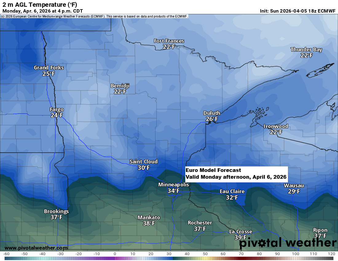
Colder air is set to move into the Northland on Monday, with highs mostly in the 20s to around 30 degrees and blustery north to northwest winds. A few flurries and snow showers are likely tonight into Monday morning, but any accumulation should be minimal for spots that see some flakes.
Temperatures Tuesday morning are expected to drop to between 5 below and 10 above zero in northeast Minnesota and northwest Wisconsin, which is quite chilly for early April. However, this could very well be the last of this kind of cold we’ll experience for several months.
Note: On April 7th, the record low in Duluth is 2 degrees, set in 1936, while International Falls holds a record low of -9 degrees, set in 1982.

…Midweek System…
A low-pressure system moving in from the northern Plains will bring some precipitation to northeast Minnesota and northwest Wisconsin from Wednesday into early Thursday. Most of it should be rain, with temperatures likely just warm enough, but parts of northern Minnesota and the North Shore could see a wintry mix of rain, snow, and some patchy freezing rain.

On Wednesday, much of northeast Minnesota and northwest Wisconsin could see around 0.1 to 0.25 inches of precipitation, with lighter amounts likely near the Brainerd Lakes.

…Long Range Trends…
The pattern looks to stay active at times over the next two weeks, with a couple of systems potentially bringing precipitation to the Northland. Ensemble models are predicting between 1 and 2 inches, and much of it could fall as rain rather than snow or other frozen types, since it’s getting pretty late in the year for snow unless the timing works out just right.


Leave a Reply