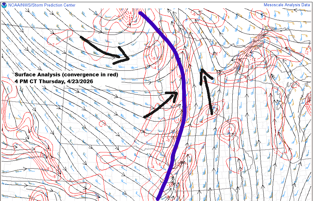
A cold front is moving east from western Minnesota this afternoon, bringing plenty of convergence both near and ahead of it.
There’s been plenty of cloud cover ahead of this boundary today, limiting the heating, but even so, instability is on the rise. Whether it’s surface-based or elevated, CAPE values are ranging from a few hundred up to around 1000 J/kg.
Showers and thunderstorms, bringing mainly heavy rain, have been moving northeast across parts of the Northland this afternoon as the aforementioned cold front approaches from the west.
Showers and thunderstorms will keep moving northeast across the area tonight, with rain tapering off from southwest to northeast. It’ll likely stick around the longest in northern Wisconsin and the Arrowhead of Minnesota, where it may not clear out until mid to late Friday morning.
As the front exits off to the east, westerly winds will pick up, with gusts between 15 and 35 mph expected in the Northland late tonight through Friday morning.
Radar loop ends 5:38 PM Thursday, April 23, 2026.
Rainfall amounts will vary across northeast Minnesota and northwest Wisconsin tonight, ranging from as little as 0.1 inches to as much as 0.5 to 1 inch or more. The heaviest rain is likely over northwest Wisconsin, the North Shore, and the Arrowhead, where multiple rounds of showers may continue into early Friday morning.

Today’s system is bringing a mid and upper-level trough that’s causing height drops of around 60 to 90 meters across the northern Plains and into parts of the upper Midwest. However, the trough isn’t expected to move much farther east before stalling and slowly drifting back west over the next few days.

Moisture is pushing north ahead of the system today, with dew points rising into the 50s and even low 60s. Behind the cold front in the Dakotas and western Minnesota, the air turns much drier.

Precipitable water, or PWATS, ranging from 1 to about 1.4 inches ahead of today’s front will bring some brief heavy downpours tonight.

Colder cloud tops, shown in brighter colors, highlight where convection has developed this afternoon, stretching from eastern Kansas up to northeast Minnesota.
Goes-19 sandwich satellite loop ending 5:06 PM CT Thursday, April 23, 2026.

The low-pressure system today is a deep one, measuring 986mb/29.12 inches, and was centered northwest of Winnipeg, Manitoba, late this afternoon. It’s expected to move slowly westward through Saturday.
Goes-19 water vapor loop ending 5 PM CT Thursday, April 23, 2026.

Early next week, a strong system is expected to move northeast out of Colorado and the central Plains, with the low likely passing south of the Northland. This setup will bring gusty northeast winds near Lake Superior from late Sunday into Monday, with gusts possibly reaching 25-40 mph.
Widespread rain is expected to hit northeast Minnesota and northwest Wisconsin from Sunday night or Monday morning through early Tuesday.

Leave a Reply