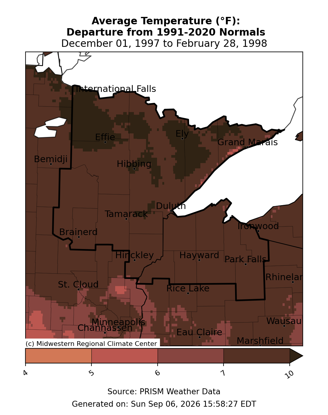
This post will examine the strong El Niño winter of 1997-98, which was several degrees warmer in Duluth compared to the similarly strong El Niño of 1982-83, illustrating that each El Niño event can vary significantly.
Let’s begin by reviewing the snowfall statistics for Duluth, Minnesota, during the winter of 1997–98.
December 1997
Total: 6.0″
Departure: -12.7″
January 1998
Total: 29.9″
Departure: +13.1″
February 1998
Total: 9.6″
Departure: -5.5″
During the December through February period, total snowfall reached 45.5 inches, falling 5.1 inches short of the average 50.6 inches.
The highest single-day snowfall in Duluth during the winter of 1997-98 was 5.1 inches on January 9.
Note: In January 1998, Duluth experienced frequent light to moderate snowfalls, resulting in a total accumulation of nearly 30 inches by the end of the month.
The seasonal snowfall in Duluth for 1997-98 totaled 80.1 inches, which was 10.1 inches below the average. November, January, and March were the snowiest months of that season.
The first snowfall measuring 1 inch or more in the 1997-98 season occurred on October 13th, while the season’s final snowfall of at least 0.1 inch fell on April 2nd.
Duluth, Minnesota Winter Temperature Data: 1997–1998
Average: 22.4 degrees
Normal: 14.6 degrees
Departure: +7.9 degrees
Note: The winter of 1997-98 was Duluth’s second warmest on record, only behind the winter of 1877-78, which still holds the record with an average temperature of 28.0 degrees.
Number of subzero nights: 8
Normal: 35
Departure: -27
The lowest temperature in Duluth during the winter of 1997-98 was -20 degrees, recorded on January 13.
Monthly subzero temperature analysis
December 1997: 1
Normal: 9
Departure: -8
January 1998: 7
Normal: 15
Departure: -8
February 1998: 0
Normal: 11
Departure: -11
Temperatures throughout northeast Minnesota and northwest Wisconsin during the winter of 1997-98 were significantly above average, ranging roughly 7 to 10 degrees warmer than normal.

Snowfall across most of the Northland during the 1997-98 winter was below average.

Across the U.S., the winter of 1997-98 resembled a typical El Niño pattern, with the northern regions experiencing warmer-than-average temperatures, the southern regions cooler-than-average conditions, and the Southwest seeing the most widespread below-average temperatures that season.

U.S. snowfall anomaly for the winter of 1997-98, with yellow, orange, and red areas indicating below-average snowfall and green and blue areas showing above-average snowfall.

Leave a Reply