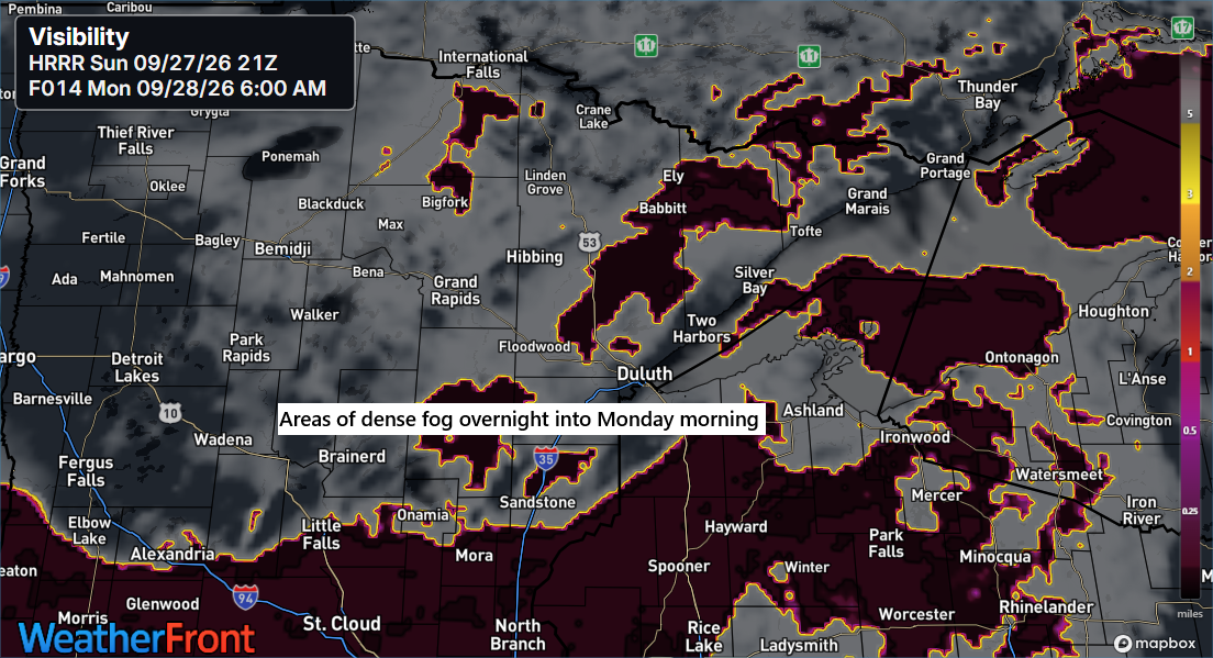
Fog is set to roll in across the Northland tonight, lingering into Monday morning before lifting by mid to late morning.
In Duluth, today’s high of 70 marks the 11th time this month that temperatures have hit at least 70 degrees. The September average is nine days reaching 70 or warmer, with the record being 25 days set in 2024.
The top five highest counts of 70-degree days in Duluth during September.
1: 25 set in 2024
2: 20 set in 2009
3: 19 set in 1948
4: 18 set in 2015
5: 17 set in 2021 and 1920
In Duluth, temperatures might reach about 70 degrees on Monday and again on Wednesday, coinciding with the final day of September 2026.
For late September, these temperatures are quite pleasant, actually about 10 degrees warmer than the average for September 27th.

The day began with heavy clouds over the Northland and a bit of light drizzle, but by the afternoon, clearer skies started to appear more often.
GOES-East visible satellite loop from Sunday, September 27, 2206, covering the period from 11:15 AM to 5:10 PM CT.
This week, there seem to be two main areas with potential for heavy rain.
The first event takes place from Monday through early Tuesday, affecting parts of North Dakota and northwest Minnesota, with expected rainfall totals of 1 to 2 inches or more.
The second system arrives midweek, spanning a wide region from the southern and central Plains to parts of the upper Midwest, where widespread rainfall totals of 1 to 2 inches or more are likely.
For northeast Minnesota and northwest Wisconsin, some rain is likely to start in northern Minnesota Monday evening or overnight, then move farther south and east on Tuesday. Rain totals in our area are expected to be lower than those forecasted farther west and south.
In Duluth, the best chance for rain this week appears to be on Tuesday, with totals possibly reaching a quarter inch or more.
The Blend of Models rainfall forecast is shown below, with totals expected through 7 AM on Friday, October 2, 2026.

Leave a Reply