6:33 PM Wednesday, December 4, 2024
Just a few more days remain to take advantage of my Black Friday deal, ending this Friday. Subscribe to my blog for an annual fee of $35, reduced from $60. You can find the subscription link below. Thank you! Subscribers receive access to in-depth discussions of long-range forecasts and early insights into weather systems that could affect the Northland, including preliminary snowfall predictions.
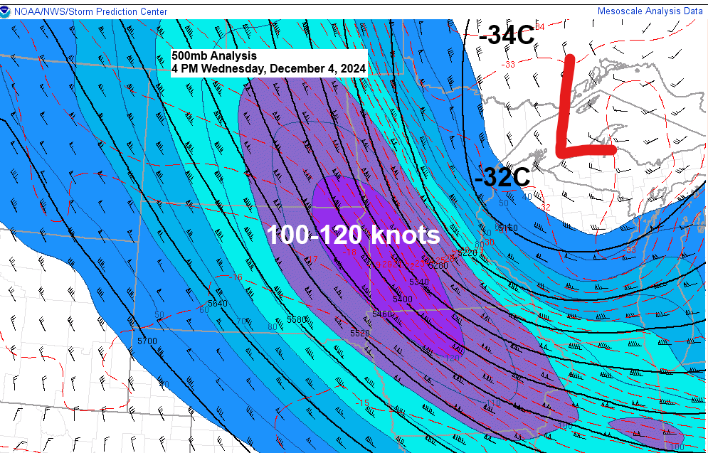
A potent upper-level trough, exhibiting 500mb temperatures down to -32C, has positioned itself over the Great Lakes region this afternoon. Accompanying this are intense winds aloft, reaching speeds of up to 140 knots at 300mb and 120 knots at 500mb, cutting across the upper Midwest in a south-southeast direction.

Northwest winds, gusting from 25 to 45 mph, are expected to persist tonight across the Northland, with the potential for gusts reaching 55 to 60 mph along the North Shore of Lake Superior. It is important to note that these strong winds may lead to power outages in some areas tonight.
HRRR model wind gust forecast through 10 AM Thursday.

The intense snow showers and squalls that emerged in parts of the Northland today have subsided by late afternoon, as the conditions most conducive to snow squall formation have moved eastward into Wisconsin and Michigan.

-Lake effect snow showers are expected tonight into Thursday along the South Shore of Lake Superior in northwest Wisconsin, primarily impacting areas of Ashland and Iron Counties.
-A few flurries and snow showers are also possible in other parts of the Northland tonight.
NAM 3km model simulated radar forecast through 6 PM Thursday.

Snowfall accumulations ranging from 3 to 6 inches or more are expected by Thursday afternoon in the northwest Wisconsin snowbelts, extending from east of Ashland to Hurley and Gile.
Less than an inch of snow in the rest of the Northland tonight.

In the Northland, temperatures are predominantly in the single digits to lower teens late this afternoon, with the cold air advection pattern persisting, albeit not as strong as earlier in the day.

Wind chill temperatures plunged to single digits and teens below zero across a broad area late this afternoon, with some areas in northwest Minnesota experiencing wind chill temperatures in the 20s below zero.

Although it’s expected to be a chilly night, the overnight temperatures won’t differ much from the early evening readings, which were already quite low as of 5 PM today.


Subscribe to continue reading
Become a paid subscriber to get access to the rest of this post and other exclusive content.