5:35 PM Monday, March 24, 2025
The weather in the Northland will be calm for the next few days, but it may change by late this week and the weekend.
Winter is trying to hold on, but the warmer temperatures of spring are becoming more widespread and intense across the Southwest and southern U.S. Eventually, the warm air will win out, but winter will try its best to linger a while longer, especially in the northern U.S. In other words, winter won’t go out without a fight; it rarely does.
Temperatures today ranged from the single digits, teens and 20s below zero well to the north, to the 80s and 90s farther south with Palm Springs, CA closing in on 100 degrees this afternoon.

There will be a significant temperature difference in Minnesota on Friday, with southern parts reaching the 70s and possibly 80s, while northeastern areas, including Duluth, will see temperatures in the 30s.
With the big temperature difference, wind will be a problem, especially near Lake Superior, where northeasterly winds could gust up to 30 or even 40 mph on Friday, and a gale may occur on western Lake Superior.

It looks windy near Lake Superior and in Duluth on Friday and Saturday with northeast winds gusting up to 30 to 45 mph. If winter precipitation occurs during this time, we might face issues like blowing snow or isolated power outages due to ice accumulation.
Euro model wind gust forecast valid 7 AM Friday to 7 AM Sunday.

The forecast is uncertain regarding wintry precipitation on Friday and this weekend.
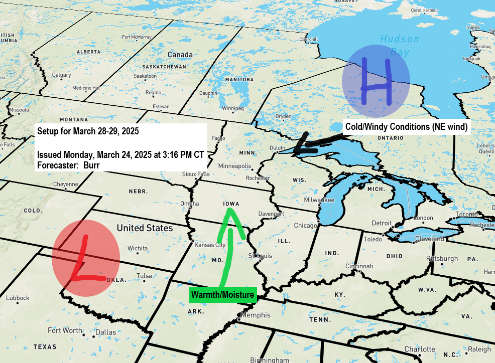
Strong high pressure is forecast to be located over Ontario and Hudson Bay, while low pressure moves into the southern and central Plains. It’s unclear how much moisture will move north into the colder air, but there is potential for snow, sleet, or freezing rain Friday and Saturday, possibly extending into early Sunday. It’s uncertain if this precipitation will be significant, but a more impactful winter weather event could affect parts of the Northland later this week and weekend.
Here are some forecasts for ice accumulation from Friday to Saturday.
Euro ensemble with a low-end amount of 0.02 inches and a high-end amount of 0.58 inches in Duluth.

Euro model shows around 0.10 inches of ice accumulation in Duluth Friday-early Saturday.

Here’s the NWS Blend of Models ice accumulation forecast from Friday afternoon to early Sunday morning.
Duluth’s amount is at around 0.15 inches of ice accumulation.

Thanks for reading!
Leave a Reply