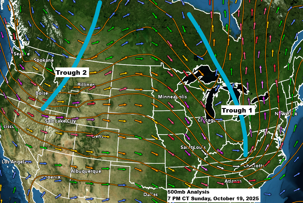
One trough has moved east of the Northland this afternoon, but right behind it comes another trough, which will deepen and take on a negative tilt as it moves southeast from the northern Rockies into the upper Midwest on Monday. This trough will then linger over the Great Lakes through Tuesday and Wednesday.
At the surface, a low-pressure system will move northeast from western South Dakota, passing near Duluth late Monday afternoon. This system will then travel over or near Lake Superior on Monday night and into Tuesday.
This system will bring increased chances of rain to northeast Minnesota and northwest Wisconsin starting Monday, with these rain chances lingering through midweek.
Gusty winds are also likely, starting from the southeast on Monday, shifting to the southwest Monday night and to the northwest on Tuesday. Wind gusts of 20 to 35 mph are expected in much of the Northland over the next few days.
Temperatures are set to drop by Tuesday and Wednesday, with highs expected to reach only the upper 30s and 40s in northeast Minnesota and northwest Wisconsin—a true taste of fall!
European model 500mb vorticity forecast valid 7 AM Monday to 7 AM Wednesday.
The strongest lift with this system will move across the Northland on Monday, associated with an occluded/cold front that lifts northeast across the area.

Monday morning in Duluth looks dry, but rain chances will rise by the afternoon, with occasional rain expected from Monday night into Tuesday.
NAM 3km model simulated radar forecast valid 7 AM Monday to 7 PM Tuesday.

There are some differences between the computer models regarding rainfall totals for Northland over the next few days.
For Duluth, the Euro and AI models are forecasting higher rain totals upwards of half an inch by 7 PM Tuesday, whereas the RAP and especially the GFS models show much less rain, with the GFS model in particular forecasting <0.10 inches of rain in Duluth by 7 PM Tuesday.


The WPC provides a solid compromise between the EURO and GFS models, predicting rain totals of about a quarter inch in Duluth by Wednesday. Higher amounts, around half an inch or more, are expected in far northern Minnesota, the Arrowhead region, and parts of far northern Wisconsin.

Leave a Reply