Here’s my updated snowfall forecast as of late Saturday afternoon.
I’m leaning more on the UK, ICON, and Canadian models for my forecast, which results in lower snowfall totals for northern Minnesota, including the North Shore and Duluth-Superior areas. I think those models are handling the setup the best on Sunday which is why I’m leaning toward those models.
*Northwest Wisconsin and a small part of far eastern Minnesota are expected to see the heaviest snowfall from this storm, with totals ranging from 6 to 10 inches. In the usual snowbelt areas along the South Shore, amounts could be even higher, reaching 10 to 20 inches or more by 9 AM on Monday.
*Snow could fall at a rate of about half an inch to an inch per hour during the peak of the storm in parts of northwest Wisconsin and far eastern Minnesota from mid to late Sunday afternoon into Sunday night, with rates possibly topping 1 inch per hour along the South Shore in northern Wisconsin Sunday night.
*Snowfall totals are expected to range from 3 to 6 inches in the Walker and Brainerd areas, including Aitkin, Moose Lake, and Hinckley.
*Snow amounts taper off to 1 to 3 inches farther north in areas like Duluth and Grand Rapids, and drop to an inch or less from Bigfork, Hibbing, and Ely up to International Falls, and east to Grand Marais.
Note: Further changes to my forecast may occur late tonight and throughout Sunday, so stay tuned for updates.

…Timing…
Light drizzle and a few showers will pass through the Northland tonight, with a thin glaze of ice possible in northern Minnesota as temperatures hover around freezing.
Precipitation is expected to become more widespread from southwest to northeast on Sunday. Precipitation could start out as rain or a wintry mix before switching to snow, and that rain/snow line should advance eastward pretty quickly through the day.
Snow will continue Sunday night but is expected to taper off from northwest to southeast overnight, with some snow lingering in northern Wisconsin near Lake Superior into Monday morning.
In the Duluth-Superior area, expect drizzle tonight continuing into Sunday morning, with snow starting to develop between 9 AM and noon. The snow will taper off late Sunday night, wrapping up between 10 PM and 1 AM.
NAM 3km model simulated radar forecast valid 6 AM Sunday to 6 AM Monday.

…Temperature trends…
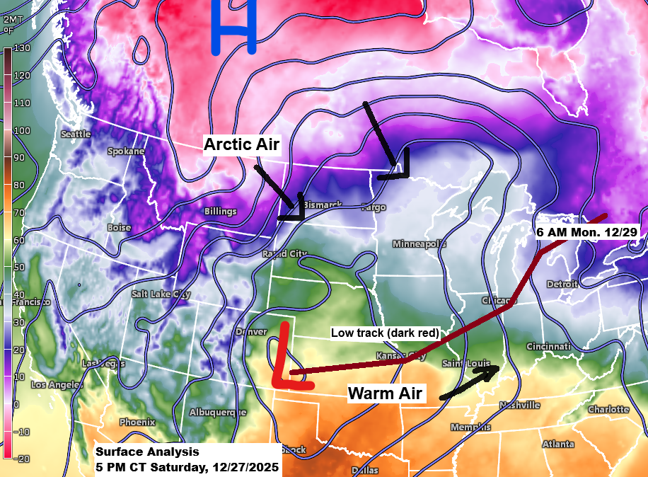
Much colder air is expected to sweep east across the Northland on Sunday.
In Duluth, temperatures will start in the mid-30s at 6 AM on Sunday, drop to the mid-20s by late afternoon, and plunge into the single digits by 6 AM Monday.
HRRR model temperature forecast valid 6 AM Sunday to 6 AM Monday.

The National Weather Service has issued several winter weather alerts for Sunday through Monday.
Note: I’m focusing on our local area in northeast Minnesota and northwest Wisconsin, but other parts of the region are also under winter weather alerts for Sunday and Monday.
A blizzard warning is in effect for parts of the south shore in northern Wisconsin (red area on the map), with wind gusts up to 45 mph and whiteout conditions expected from mid to late Sunday afternoon through Monday morning. Travel will be dangerous and potentially life-threatening, especially along Highway 2 on the south shore, where the strongest gusts are likely.


…Strong Winds…
North to northwest winds will strengthen across the Northland on Sunday, with the most powerful gusts arriving Sunday afternoon and lasting into the evening, continuing through Monday. Typical gusts will range from 15 to 30 mph, with stronger bursts of 35 to 60 mph, especially along the North Shore Sunday night into Monday.
Strong winds will whip up blowing and drifting snow across parts of the Northland from Sunday afternoon into Monday, with blizzard and whiteout conditions expected along the South Shore in northern Wisconsin, stretching from Ashland to Gile and Hurley.
Euro model wind gust forecast valid 6 AM Sunday to 6 PM Monday.

…Wind Alerts…
A high wind warning and wind advisory are in effect for the North Shore of Lake Superior in northeast Minnesota from Sunday evening through Monday, with storm and gale warnings issued for the western, central, and southern parts of Lake Superior.

…Dense Fog Continues…
A dense fog advisory is in effect through early Sunday morning for the North Shore, including Duluth and parts of east central Minnesota, with visibility in some areas reduced to a quarter mile or less. The fog is expected to lift from west to east on Sunday morning as colder air moves in.

Make a one-time donation
Make a monthly donation
Make a yearly donation
Choose an amount
Or enter a custom amount
If my storm updates help you stay ahead of the weather, feel free to toss a few flakes into the tip jar. Thank you!
Your contribution is appreciated.
Your contribution is appreciated.
DonateDonate monthlyDonate yearly
Leave a Reply