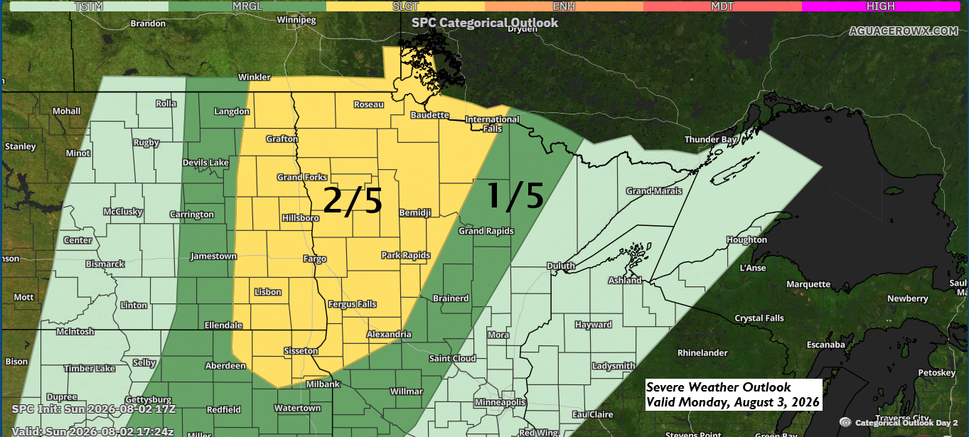
A cold front will move east from the Dakotas on Monday, crossing the Northland late Monday night into early Tuesday morning. It’s expected to bring the next round of rain to northeast Minnesota and northwest Wisconsin, though not everyone will get much, which is pretty typical for summer.
Showers and thunderstorms are likely to develop in eastern North Dakota and from northwest to western Minnesota by mid to late Monday afternoon, continuing into the early evening. The storms will push farther east Monday night, mainly after sunset.
Strong jet dynamics, instability, and wind shear are setting the stage for scattered severe thunderstorms Monday afternoon and evening, mainly from eastern North Dakota into west-central and northwest Minnesota, where model data shows the highest potential for severe weather. These storms could bring large hail up to ping pong ball size (1.5″ diameter), powerful winds of 60-75 mph, and possibly one or two tornadoes.
It’s a bit uncertain how far east the threat for severe weather will reach, though a few strong to severe storms could move into north-central Minnesota late Monday evening or early Tuesday morning, with wind and hail being the main concerns.
According to the NAM model, the 0-3 KM Energy Helicity Index (EHI) shown below indicates favorable conditions for some severe weather late Monday afternoon and evening, particularly in the yellow and orange shaded areas. However, the eastern extent of this severe risk remains somewhat uncertain at this time.

The NAM-Nest and HRRR models both point to thunderstorms developing late Monday afternoon in northwest and western Minnesota, with strong agreement on this outlook. These storms should track east through the night, though they may lose some intensity as they progress.


According to the NWS Blend of Models forecast, rainfall of about half an inch to over an inch is most likely across a corridor from western to northern Minnesota through 7 AM Tuesday, with lighter amounts expected farther east, including the Arrowhead, Twin Ports, east-central Minnesota, and northwest Wisconsin.

Another round of low clouds and fog may drift inland from Lake Superior tonight, affecting parts of the North Shore, South Shore, and Twin Ports area. The fog isn’t expected to be as thick as it was in some spots Sunday morning, and any that forms late tonight should clear out by mid-morning Monday.

If you’d like to donate, you’re welcome to do so below
Make a one-time donation
Make a monthly donation
Make a yearly donation
Choose an amount
Or enter a custom amount
Your contribution is appreciated.
Your contribution is appreciated.
Your contribution is appreciated.
Leave a Reply