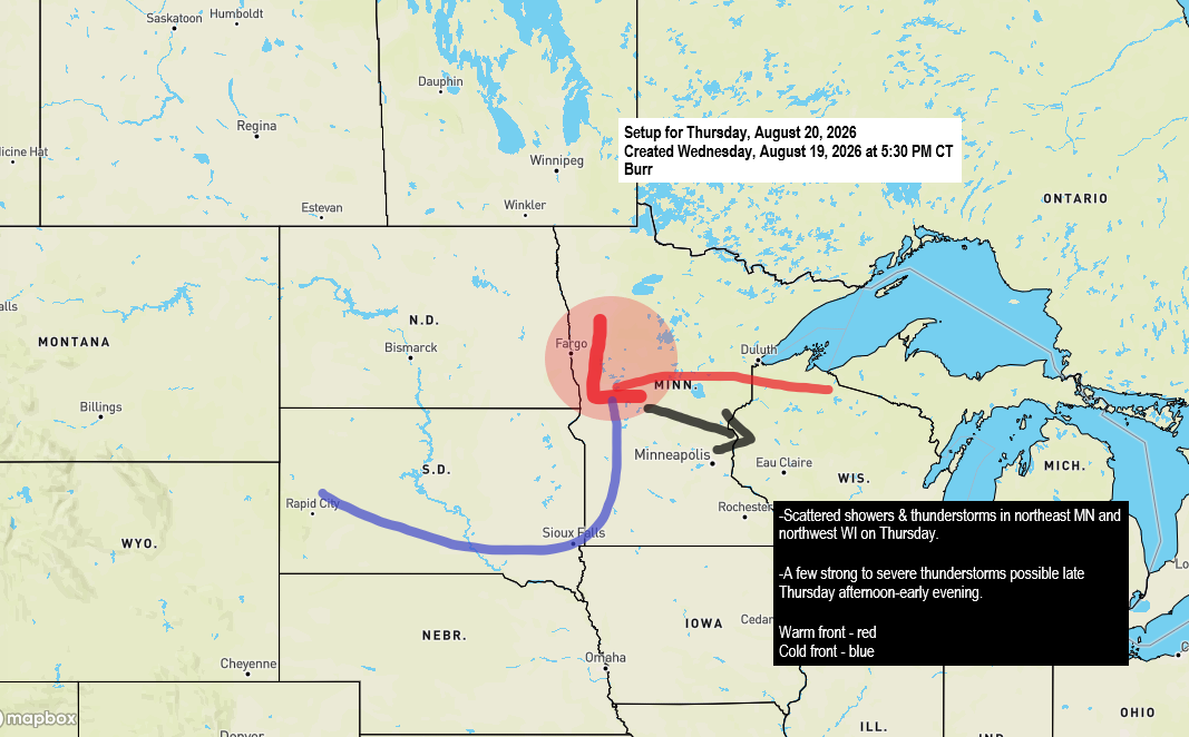
There’s a chance of rain in the Northland on Thursday as a low-pressure system moves east-southeast from northern North Dakota, resembling a mid-August clipper.
This system is expected to bring two rounds of precipitation. The first will occur during the morning and early afternoon, with scattered showers and isolated thunderstorms passing through parts of the Northland. A second round of scattered showers and thunderstorms may develop by late Thursday afternoon and continue into the evening before the system moves southeast.
It’s Thursday afternoon into the evening, which could bring a chance of strong to severe thunderstorms across parts of the Northland, particularly from east-central Minnesota into northwest Wisconsin. The severity will depend on how much clearing follows the morning showers, as this will influence afternoon temperatures, atmospheric instability, and the buildup of moisture for a potential late-day storm round.
A few storms late Thursday afternoon into early evening could produce damaging winds up to 60 mph and hail as large as ping pong balls (1.5″ diameter). With a warm front and a nearby low, there is also a conditional risk of an isolated tornado, depending on how conditions develop Thursday afternoon.
HRRR model simulated radar forecast valid from Midnight tonight to 1 PM Thursday.
If you’d like to donate, you’re welcome to do so below.
Make a one-time donation
Make a monthly donation
Make a yearly donation
Choose an amount
Or enter a custom amount
Your contribution is appreciated.
Your contribution is appreciated.
Your contribution is appreciated.
Here are several potential scenarios from the computer models regarding the thunderstorm threat late Thursday afternoon.
RRFS model (6 PM Thursday)

NAM-Nest model (6 PM Thursday)

HRRR model (6 PM Thursday)

By late Thursday night, northeast Minnesota and northwest Wisconsin could see around a quarter to half an inch of rain, with isolated areas potentially receiving an inch or more.

If you look closely, you can notice a bit of a spin over Saskatchewan, which is the system expected to move southeast through the Northland on Thursday. There should be ample lift with this system, which will likely help generate some rain.
Goes-19 visible satellite loop from Wednesday, August 19, 2026, loop time ends 5:30 PM CT.

Leave a Reply