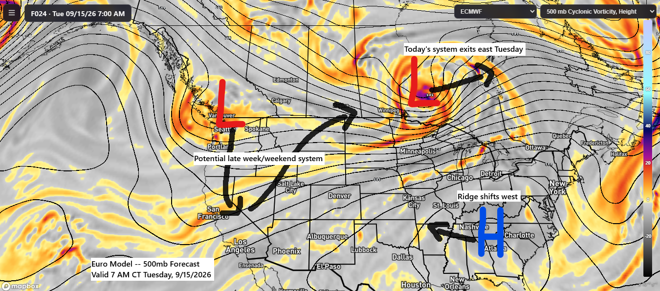
Over the next several days, today’s system will move quickly northeast by late tonight, while a strong upper-level ridge over the southeastern U.S. expands westward. Meanwhile, another system over the Pacific Northwest is forecast to dip south before lifting northeast out of the Rockies later this week and into the weekend.
A strong low-pressure system was centered over southeast Saskatchewan this afternoon, with a trailing cold front stretching south through the northern and western High Plains. Ahead of this system, a potent southerly low-level jet reaching up to 55 knots transported warmer, more humid air northward. Combined with lift from the front and the influence of dual jet streaks enhancing upward motion, these conditions contributed to widespread rainfall across the Northland today.
Today’s system is drawing energy from a strong temperature gradient, with 50s and 60s in Minnesota contrasting with highs in the 90s to nearly 100 degrees in Kansas.

For Duluth: Rain is expected to taper off by late tonight, with the heaviest downpours occurring mostly before 7 PM and only a few lingering showers continuing mid to late evening.
Radar loop from Monday, September 14, 2026, showing data from 3:43 PM to 5:42 PM CT.
The precipitation totals depicted on the map may be somewhat overstated in certain areas; however, overall, up to a quarter inch or more of additional rainfall is anticipated across much of the region this evening.
As of 5 PM today, the Duluth Airport has received 0.35 inches of rain.
An overview of the expected additional rainfall through late tonight.

Goes-19 water vapor loop from Monday, September 14, 2026, depicting a powerful system over southern Saskatchewan poised to move into Manitoba tonight.
Winds in the Northland will shift southwest overnight, then to the west-northwest on Tuesday. Wind gusts from 15-30 mph are likely with potentially stronger gusts up to 45 mph Tuesday morning.
Expect gales and occasional storm-force wind gusts on Lake Superior Tuesday, with westerly winds reaching 35 to 50 mph.
NAM-Nest model forecast for wind gusts, valid from 1 AM to 7 PM Tuesday.
West gale expected on Lake Superior Tuesday, with the highest waves primarily east of the North Shore, reaching 8 to 13 feet..

Leave a Reply