Category: blizzard warning
-

More snow on the way through Tuesday along with some rain, fog and freezing rain tonight; Updated Snowfall Forecast
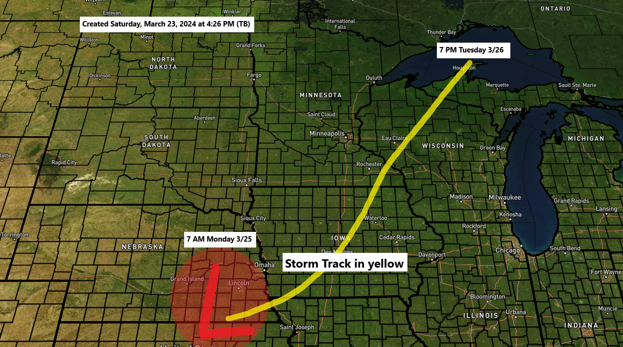
6:26 PM Monday, March 25, 2024 We have about 24 more hours left to go of this winter storm as of late Monday afternoon. Here’s my snowfall forecast through 7 PM Tuesday. Amounts on the map are additional accumulations. Note: Locally higher amounts exceeding 8 inches are possible anywhere in…
-
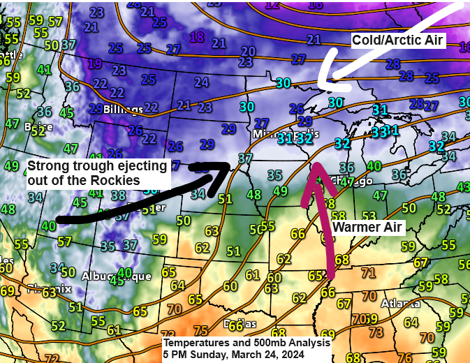
Winter/Spring Storm continues; Updated Snowfall Forecast (3/24)
6:30 PM Sunday, March 24, 2024 -A major winter/spring storm will continue to impact the Northland through Tuesday. -Gusty winds, snow/blowing snow, some rain and freezing rain are likely through Tuesday. -Periods of whiteout/near whiteout conditions especially near Lake Superior due to falling and blowing snow tonight and Monday. Still…
-
Winter Storm arrives Sunday; Updated Snowfall Forecast
6:12 PM Saturday, March 23, 2024 A major winter/spring storm will impact the Northland over the next few days. There’s been some notable trends in the computer models today especially in the Euro model as the Euro has shifted the storm track more to the east and more in line…
-

Gusty Winds with some snow and blowing snow tonight; Updated Snowfall Forecast
5:02 PM Friday, January 12, 2024 A large winter storm will continue to track northeast out of northeastern Illinois tonight. Although the center of the low is passing well southeast of the Northland, this storm will still bring some snow to the Northland tonight, but snowfall amounts have decreased quite…
-
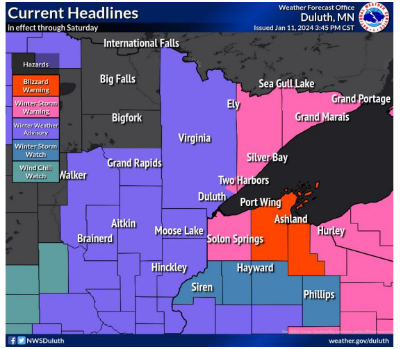
Blizzard Warning issued for parts of the South Shore of Lake Superior
5:38 PM Thursday, January 11, 2024 A major winter storm will impact parts of the Northland Friday into Saturday with the worst conditions expected in northwest Wisconsin especially along the South Shore of Lake Superior where blizzard conditions are expected from Friday afternoon through Saturday morning east of the city…