Tag: snow depths
-
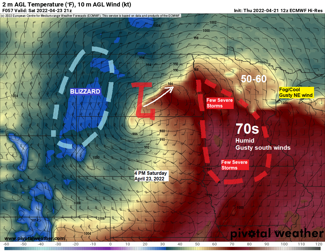
Another Spring Storm on the way Friday PM-Sunday; Occasional showers, t-storms and gusty winds for the Northland; Blizzard to hit western North Dakota
6:48 PM Thursday, April 21, 2022 Some parts of the Northland could have temperatures in the 60s to around 70 from mid to late afternoon on Saturday, but this won’t be happening near Lake Superior including in Duluth where I expect much cooler temperatures (30s and 40s), strong northeast winds…
-
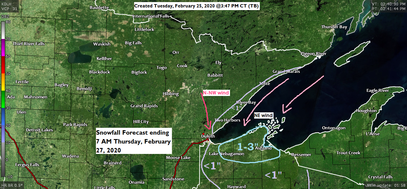
Colder temperatures the next few days; some snow showers and flurries tonight and Wednesday
Snow Depths from around the Northland as of Tuesday morning, February 25, 2020. Source: https://www.weather.gov/dlh/ Wolfridge, MN: 36″Hurley, WI: 27″4 E Island Lake, MN: 25″Babbitt, MN: 24″Duluth Airport: 23″Northome, MN: 23″Cass Lake, MN: 21″Embarrass, MN: 20″Ely, MN: 20″Kabetogama, MN: 20″4 W Clam Lake, WI: 20″International Falls, MN: 19″3 E Orr,…
-
Very cold and breezy tonight and Saturday; Warming up Sunday-Tuesday. Snow depth reports from around the Northland in this post
/Issued 4:51 PM CST, Friday, January 6, 2017/ Photo of Lake Superior taken by me on this 6th day of January 2017. Source: http://wx.aerisweather.com/ Wind Chill Advisory for all of northeast Minnesota and northwest Wisconsin, more information at this link http://wx.aerisweather.com/local/us/mn/duluth/warnings.html Source: http://www.dnr.state.mn.us/ Minnesota snow depth map as of January 5,…
-
January 24, 2014 – Weather Report. Turning windy and sharply colder Tonight — Wind chill advisory for parts of the Northland.
/Issued 3:24 PM CST, Friday, January 24, 2014/*Expect windy conditions to develop Tonight. This is the 850mb wind forecast per 18z GFS model valid for the hours after 12 AM Tonight. The yellow and red colors indicate wind speeds of 40-50 knots up at around 5,000 feet. Some of this…