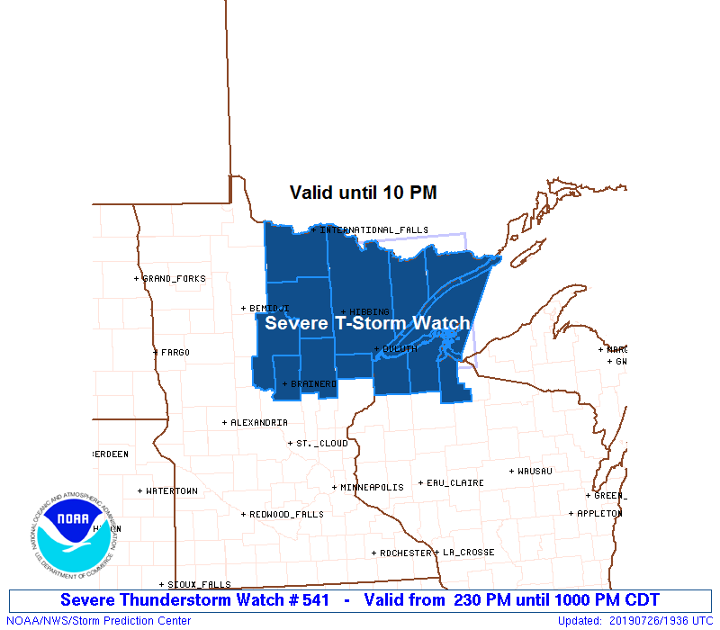
Severe Thunderstorm Watch has been issued by the Storm Prediction Center for Northern Minnesota, Northern Wisconsin and Lake Superior (blue shaded area on map below) This watch is in effect until 10 PM this Friday evening.
Primary threats include
- Scattered large hail and isolated very large hail events to 2 inches in diameter possible
- Scattered damaging wind gusts to 70 mph possible
- A tornado or two possible
Source: https://www.spc.noaa.gov

Clearing skies in parts of northeast Minnesota this afternoon is leading to an unstable atmosphere. Cold front and upper low approaching from the west will move into this warm, humid and unstable air which should cause scattered thunderstorms to develop through early this evening. A few storms could be strong to severe, but not everyone will get hit as these storms should remain isolated to scattered in coverage.
Seeing some decent convergence setting up this afternoon with south-southwesterly winds ahead of a cold front and west winds behind the boundary.
Source: https://weather.cod.edu

Tim
Leave a Reply