Record Low Temperatures set in the Northland this morning, Tuesday, July 30, 2019.
International Falls, Minnesota: New record low of 37 degrees set on July 30, 2019. Previous record low 38 degrees set on July 30, 1898 or 121 years ago.
Hibbing, Minnesota: New record low of 37 degrees set on July 30, 2019. Previous record low 41 degrees set on July 30, 1964, and tied in 1971, 1992 and 2004.
Low Temperature Reports from Tuesday morning, July 30, 2019
Source: https://www.weather.gov/dlh/
- Eveleth, MN: 37 F
- Chisholm-Hibbing, MN: 37 F
- International Falls, MN: 37 F
- Crane Lake, MN: 39 F
- Bigfork, MN: 39 F
- Embarrass, MN: 40 F
- Aitkin, MN: 41 F
- Cass Lake, MN: 43 F
- Northome, MN: 43 F
- Hill City, MN: 43 F
- Silver Bay, MN: 43 F
- Ely, MN: 43 F
- McGregor, MN: 43 F
Walker, MN: 43 F - Hermantown, MN: 45 F
- Moose Lake, MN: 45 F
Record lows for July 31 — See list below
- Ashland, WI: 36 F set in 1924
- International Falls, MN: 39 F set in 1898 and tied in 1906
- Hibbing, MN: 40 F set in 1971
- Duluth, MN: 42 F set in 1924
- Brainerd, MN: 44 F set in 1974 and tied in 1992
Low temperature forecast for Wednesday morning, July 31.
Source: https://graphical.weather.gov

High temperature forecast for Wednesday, July 31.

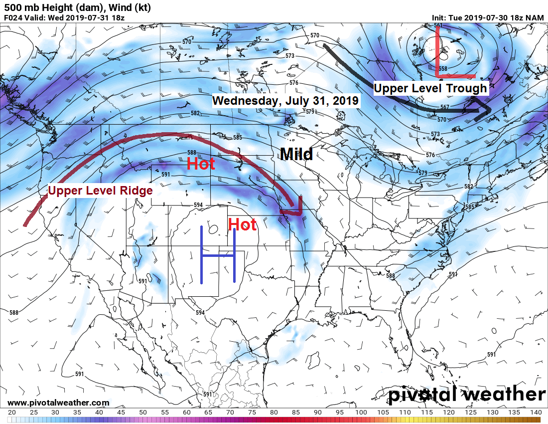
500mb forecast valid for Wednesday, July 31, 2019 per 18z NAM model.
Source: https://www.pivotalweather.com

…Weather Summary…
An area of high pressure was over the upper Midwest late this afternoon with a northwest flow aloft in place.
Another pleasantly cool night is on the way under mainly clear skies. Patchy fog is possible early Wednesday morning. Lows tonight will range from around 40 to the middle 50s (mildest temps near Lake Superior) Light winds through the night.
Mild temperatures Wednesday with another day with low humidity. Mostly sunny skies with highs in the middle 70s to around 80. High pressure moves off to the east causing winds to shift to the south on Wednesday with those southerly winds in the 10 to 15 mph range.
Turning more humid Thursday and a muggier airmass could linger through the weekend. Dew points are forecast to climb into the 60s Thursday and could remain in the 60s right through the weekend. Also looks warm Thursday through Sunday with daytime highs in the mid 70s to mid 80s.
Instability will be on the increase late this week and this combined with a frontal boundary over or near the Northland should be enough to trigger isolated to scattered showers and thunderstorms Thursday through Sunday. Note: The chance for severe weather looks pretty low due to weaker winds aloft and very little wind shear, instead we’re probably looking at outflow dominant (pulse) type storms with heavy downpours, some lightning and possibly some gusty winds. Not expecting all day rains with this kind of setup, but if a storm hits your location, then a heavy downpour will likely occur.
Leave a Reply