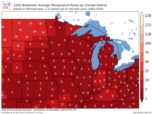
*Average temperatures so far this month across the Northland are running about 6 to nearly 9 degrees warmer than average.
*Precipitation so far this month varies from >1″ above normal at Duluth, to nearly 0.50″ below normal at International Falls.
*Snowfall so far this month is running >11″ above normal at Duluth, to nearly 5″ below normal at International Falls.
Note: Listed below are the climate stats for November 2020 from the 1st thru 15th.
| Duluth, Minnesota Average temperature: 39.7 degrees Departure: +6.9 degrees above normal Total precipitation: 2.21″ Departure: +1.09″ above normal Total snowfall: 16.7″ Departure: +11.4″ above normal |
| International Falls, Minnesota Average temperature: 37.2 degrees Departure: +7.1 degrees above normal Total precipitation: 0.31″ Departure: -0.47″ below normal Total snowfall: 1.0″ Departure: -4.6″ below normal |
| Brainerd, Minnesota Average temperature: 40.4 degrees Departure: +5.8 degrees above normal |
| Hibbing, Minnesota Average temperature: 35.3 degrees Departure: +5.1 degrees above normal |
| Ashland, Wisconsin Average temperature: 43.6 degrees Departure: +8.6 degrees above normal |
The entire Northland is running well above normal in the temperature department so far this month, but the prolonged ‘heat wave’ we had earlier in the month is certainly the reason behind why we are still running so far above average despite the cooler temps over the last week.
Source: https://mrcc.illinois.edu/

A wet November so far across all but northwest portions of the area.

Precipitation totals so far this month are running 186% of normal at Duluth compared to just 37% of normal at International Falls.

Snowy in the middle, less snow on the edges.

Total snowfall so far this month is running 283% of normal at Duluth compared to just 16% of normal at International Falls.

What does the second half of November have in store for the Northland?
Certainly doesn’t look like will be dealing with any arctic air masses for the rest of the month, in fact the pattern should support warmer than average temperatures thru the end of the month. Note: Normal highs in mid November are in the low to mid 30s, while normal lows are in the upper teens and lower 20s. By the end of November, normal highs range from the mid to upper 20s, while normal lows range from the upper single digits to middle teens. Long range model guidance shows that our temperatures should remain above those aforementioned normal values, in fact we could have a few days later this week with daytime highs in the 40s, and possibly even close to 50 degrees.
Source: https://home.pivotalweather.com/

As for precipitation, this week looks dry, but there are some signs showing up in long range model guidance for a more active weather pattern starting sometime next week which could increase the chances for rain or snow across the Northland.
Thanks for reading!
Tim
Leave a Reply