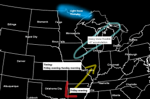
Far northern Minnesota could see a little snow or a wintry mix of precipitation on Thursday as an area of low pressure moves quickly to the ENE out of western Minnesota. This won’t be a huge storm, however, with snow totals ranging from less than an inch from around Bigfork to Grand Marais to about 1 or 2 inches along the Borderland, from around International Falls to Grand Portage. Note: International Falls has only picked up 9.1″ of snow so far this season, this is -11.4″ below normal thru December 10, while Duluth has picked up 31.2″ of snow so far this season which is +10.2″ above normal thru December 10.
Note: A much stronger system (heavy snow) is possible this weekend, but this one should remain well to the SE of the Northland with no snow expected in our area, but an exception to this may be near Lake Superior especially along the South Shore (east of Duluth) where some lake effect snow could develop from late Friday into Saturday as NE winds blow down the lake, but the air mass doesn’t look particularly cold, with 850mb temps ranging from -5 to -8C per model guidance, so if any lake effect snow develops Friday or Saturday it doesn’t look like it would amount to much.

Looks like all of the precipitation with Thursday’s system will remain north of Duluth and Superior.
18z NAM 3km model simulated radar forecast valid from Midnight tonight to 6 PM Thursday.
Source: https://weathermodels.com/

Thursday looks like another mild day in Duluth, but after that temperatures cool down a bit, at least will be closer to normal for mid December, but still not seeing any subzero temps in Duluth through December 19.
Note: Normal highs in Duluth from December 10 to December 19 are in the low to mid 20s, while normal lows fall from 9 degrees on the 10th, to 6 degrees on the 19th.
Source: https://weathermodels.com/

Another blowtorch across the upper Midwest today including here in the Northland with widespread 40s today. Rapid City, SD hit 70 degrees today!

The heat miser continues to do its thing today.
Temperatures running about 20 to 35 degrees above normal over a large area on this 9th day of December 2020.
Source: https://lab.weathermodels.com/

Record to near record warmth (colored circles on map below) extending from Texas to Minnesota today.
Source: http://coolwx.com/

So where is the arctic air? It remains bottled up over portions of Russia, Alaska and Northwest Territories where temperatures are as cold as -40 to -45 degrees today.
Note: The pattern ahead still looks relatively mild for the Northland, but a few shots of colder temperatures (possibly arctic air at times) are possible mid to late month, but they don’t appear to have very much staying power, lasting maybe 1 or 2 days the way it looks now.

Thanks for reading!
Tim
Leave a Reply