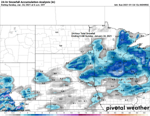
A light fluffy snowfall accumulated to 1 to 4 inches in northeast Minnesota and northwest Wisconsin late Saturday afternoon into early Sunday morning.
Snowfall Reports from January 23-24, 2021
Source: https://www.weather.gov/dlh/
- 3 WSW Iron Junction, MN: 4.5″
- 4 W Grand Marais, MN: 3.9″
- 4 NNW Knife River, MN: 3.5″
- 1 WSW Blackberry, MN: 3.5″
- International Falls, MN: 3.4″
- 7 N Cohasset, MN: 3.0″
- 3 W Iron Junction, MN: 3.0″
- Duluth Airport: 2.8″
- 2 SW Moose Lake, MN: 2.8″
- 6 NE Little Round Lake, WI: 2.7″
- 4 WSW Grand Marais, MN: 2.5″
- 3 NW Friesland, MN: 2.3″
- 4 SSE Herbster, WI: 2.3″
- 1 NE Duluth, MN: 2.2″
- Butternut, WI: 2.0″
- 1 SSE Two Harbors, MN: 2.0″
- Solon Springs, WI: 2.0″
- 1 ESE Lester Park, MN: 1.8″
- 1 SW Gilbert, MN: 1.8″
- 3 SW Pine Center, MN: 1.8″
- 2 NW Duluth, MN: 1.5″
- 2 SSE Pine River, MN: 1.5″
- 2 N Fort Ripley, MN: 1.3″
*1.6″ of snow at the Duluth Airport on January 23, 2021, this is the first 1″ or greater calendar day snow event in Duluth since December 30, 2020 when 3.3″ of snow fell.
*5.4″ of snow so far this month in Duluth, normal snowfall to date is 15.1″. We’ve only had 36% of our normal snowfall to date.
Right back into a dry weather pattern across the Northland over the next few days, but this has been the case for almost a year now as a wetter pattern just hasn’t been able to lock into place around here, we tend to go days/weeks between precip events, hence why we’re so far below normal in precipitation going back to last year, eventually this pattern has to break, but when is the unknown. Note: Our next shot for some snow for the Northland could come next weekend (~January 29-31) but there isn’t much model agreement yet on the track of a low pressure system for the aforementioned time frame.
A winter storm will affect parts of the Midwest Monday into Tuesday, and it could be a significant one, but it will remain well south of the Northland with no snow impacting our local area.
Winter Storm Warnings in pink
Winter Storm Watches in blue
Winter Weather Advisories in purple

A swath of 6 to as much as 12 inches of snow is possible Monday into Tuesday morning stretching from northern Kansas and southern Nebraska, east through southern/central Iowa into northern Illinois.
Source: https://weathermodels.com/

Tim
Leave a Reply