5.47″ of precipitation has fallen in Duluth since March 1st, which is nearly +2″ above normal to date (+1.95″) or some 155% of normal through April 26th.
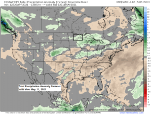
The only way we were going to start chipping away at our precipitation deficit (which was ~10″ going into 2021) in Duluth was by getting into a much more active weather pattern with more frequent precipitation events, and sure enough this is what has been happening in the Twin Ports since January 1st, with 6.61″ of precipitation so far this year which is +1.32″ above normal to date. No signs this pattern is gonna change much looking out the next two weeks as precipitation totals are forecast to be near to above normal across northeast Minnesota and northwest Wisconsin, so if and when we get a day without any rain, enjoy it, so Tuesday and Wednesday look to be those days as it looks dry in Duluth. We could see a few showers return on Thursday, and possibly some more showers at times this weekend.
- Rain continues in northwest Wisconsin late this afternoon but this rain will be tapering off from west to east this evening.
- Some more showers are possible Tuesday mainly over northwest Wisconsin and possibly in far eastern Minnesota.
- It looks dry across northern Minnesota tonight and Tuesday.
18z NAM 3km model simulated radar forecast thru 7 AM Wednesday.

No doubt about it spring 2021 has been much wetter in Duluth compared to spring 2020 with just 2.16″ of precipitation last spring from March 1st to April 26th compared to nearly 5.50″ for the same period this spring.
Spring 2021 in Duluth is currently running +3.31″ wetter to date compared to spring 2020.
Spring 2021 has been a wet one in Duluth with several precipitation events (17 of them) for the period March 1st to April 25th.

- Average date for first 70 degree temperature in Duluth is April 28th, so this year’s first 70 will occur a little later than normal, how much later? Time will tell. By the way last year’s first 70 in Duluth didn’t occur until May 20th!
48% of days this month have had a below average high temperature (blue), while 44% of days have had an above average high temperature (red) in Duluth.
April 2021 is running +2.4 degrees warmer than average thru April 25th.

The good news is that today is likely the coldest day will have in Duluth for the next 10 days, but the bad news is I don’t see anything too warm when it comes to our high temps through May 6th.
Will likely be dealing with an easterly wind as well on some of the days through May 6th so that will keep things cooler by the lake on the days we have an east wind.
Note: Normal highs in Duluth are in the mid to upper 50s and normal lows are in the mid to upper 30s from April 27th to May 6th.

…Precipitation Totals from April 25-26, 2021…
Note: Totals listed below are for the 24 hour period ending 5 PM Monday, April 26, 2021.
Source: https://mesowest.utah.edu/
- Hill City, MN: 0.64″
- Duluth Airport: 0.63″
- Saginaw, MN: 0.60″
- Barnes, WI: 0.58″
- Brainerd, MN: 0.42″
- Moose Lake, MN: 0.38″
- Hinckley, MN: 0.37″
- Grand Rapids, MN: 0.30″
- Grand Marais, MN: 0.30″
- Ashland, WI: 0.30″
- Solon Springs, WI: 0.26″
- Chisholm-Hibbing Airport: 0.25″
- Siren, WI: 0.24″
- Hayward, WI: 0.24″
- Longville, MN: 0.18″
- Bigfork/Effie, MN: 0.02″
…Snowfall Reports from Sunday night/Monday morning, April 25-26, 2021…
Note: On average, today’s date April 26th is when we typically see our last snowfall of at least 0.1″ in Duluth, however, the latest last 0.1″ or greater snowfall on record in Duluth didn’t occur until May 28th in 1965.
Source: https://www.weather.gov/dlh/
- 11.8 NNE Duluth, MN: 1.5″
- 9.8 W Ashland, WI: 1.1″
- 4.4 W Grand Marais, MN: 1.0″
- Babbitt, MN: 0.8″
- Duluth Airport: 0.6″
- Wolf Ridge, MN: 0.5″
- Cook, MN: 0.4″
- 3 E Wright, MN: 0.3″
- Butternut, WI: 0.3″
- Embarrass, MN: 0.2″
Well that is one strong warm front today! Temperatures this afternoon ranged from the mid 90s at Hill City, Kansas to the low and mid 30s along the North Shore of Lake Superior in northeastern Minnesota.

A large mid/upper level trough continues to move slowly east out of the western U.S. today while subtropical moisture (green arrow) lifts NE out of the Southern Plains.
Rain chances for the next few days will be greatest south of northeast Minnesota as a frontal boundary remains nearly stationary across the Midwest.
Water vapor loop from Monday, April 26th, 2021.

Tim
Leave a Reply