Rain chances will continue in much of the Northland tonight, but on Friday those chances for rain will be highest in northwest Wisconsin, while mainly dry conditions or only a few isolated showers will be found across northeastern Minnesota.
Saturday looks dry across the entire Northland, but scattered showers and isolated thunderstorms are possible Saturday evening into Sunday as a cold front moves through the area and then stalls out well to our south on Sunday.
Chances for any severe weather remain very low across the entire Northland through Sunday as lapse rates remain very poor, while the amount of instability isn’t particularly high or at least at levels that could help trigger severe weather. Winds aloft aren’t very favorable as well for anything more than a general thunderstorm risk through this weekend the way it looks now.
Warmest days Friday and Saturday with high temps in the 70s and 80s in northeast Minnesota and northwest Wisconsin, it will also remain humid both days with dew points in the mid 50s to mid 60s.
The weather near Lake Superior won’t change a whole lot through Sunday with occasional fog (possibly dense at times) generally light winds through Saturday, but a strong NE wind develops Sunday with wind gusts of 20-30+ mph possible. Highs near Lake Superior will be in the 50s and 60s Friday and Saturday, and from 37 to 43 degrees on Sunday.
NAM 3km model simulated radar forecast valid through 7 AM Saturday.

Here’s a look at how much more rain could fall through early Friday evening.

…24-Hour Rainfall Reports across the Northland ending 4 PM Thursday, May 20, 2021…
- Hinckley, MN: 1.06″
- Moose Lake, MN: 0.87″
- Clam Lake, WI: 0.85″
- Saginaw, MN: 0.81″
- Cloquet, MN: 0.80″
- Chisholm-Hibbing Airport: 0.69″
- Two Harbors, MN: 0.66″
- Hayward, WI: 0.66″
- Superior Airport: 0.65″
- Ashland, WI: 0.57″
- Duluth Airport: 0.56″
- Effie-Bigfork, MN: 0.47″
- Grand Marais, MN: 0.45″
- Orr, MN: 0.45″
- Glidden, WI: 0.44″
- Walker, MN: 0.41″
- Eveleth-Virginia, MN: 0.39″
- Skibo, MN: 0.37″
- Longville, MN: 0.35″
- Ely, MN: 0.35″
- Pine River, MN: 0.30″
- Minong, WI: 0.30″
- Aitkin, MN: 0.27″
- Isabella, MN: 0.26″
- Solon Springs, WI: 0.25″
- Barnes, WI: 0.25″
- Cass Lake, MN: 0.24″
- Washburn, WI: 0.24″
- Littlefork, MN: 0.23″
- Siren, WI: 0.16″
- International Falls, MN: 0.15″
- Brainerd, MN: 0.14″
- Hill City, MN: 0.11″
- Grand Rapids, MN: 0.07″
Multiple waves of rain (heavier downpours in yellow and orange colors) moved through the Northland today – Radar loop from 5:50 AM to 5:01 PM, Thursday, May 20, 2021.

Much of northeast Minnesota and northwest Wisconsin received some rain the last few days, with even heavier rainfall totals in parts of far northwest Minnesota and eastern North Dakota on Wednesday.

A few low-topped supercell type thunderstorms developed across south-central Minnesota early Wednesday evening with preliminary reports of 7 tornadoes associated with those storms – See list below.
Note: The majority of these tornadoes touched down on or very close to Interstate 35.
#1: 7:25 PM – Tornado 4 miles west of Owatonna, MN.
#2: 7:25 PM – Tornado 3 miles west of Owatonna, MN.
#3: 7:43 PM – Tornado 4 miles west of Owatonna, MN.
#4: 7:45 PM: Tornado 3 E of Morristown, MN.
#5: 8:01 PM: Tornado 4 ENE of Henderson, MN.
#6: 8:21 PM: Tornado 6 WSW Dundas, MN.
#7: 8:42 PM: Tornado 2 E of Elko New Market, MN.

…Drought Update…
Latest drought monitor as of May 18th, 2021 shows much of North Dakota and northern South Dakota in D3/Extreme Drought (red on map) with even some parts of North Dakota in D4/Exceptional Drought (dark red on map)
Portions of northwest and southern Minnesota and southern Wisconsin are in D1/Moderate Drought (light orange on map)
Note: 84% of North Dakota is in Extreme Drought, with 16% of North Dakota in Exceptional Drought.
In the Northland, only far northern areas are classified as being Abnormally Dry (yellow on map), while the rest of the Northland remains drought free this week.

Several wildfires are burning across southern portions of Manitoba province Canada, with 9 of them out of control as of Wednesday evening, May 19th, 2021.

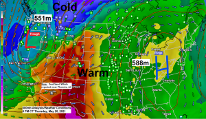
For those missing cold temperatures and snow this is for you!
Western Montana and eastern Idaho are the places to be today if you like some snow in May!
Look at that temperature contrast in Big Sky Country today, ranging from the 20s and 30s in the western part of Montana to the 80s in southeast Montana.

Winter Storm Warnings and Advisories remain in effect through Friday morning in parts of Montana and Idaho.

Tim
Leave a Reply