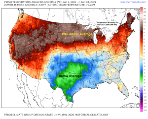
A very warm June thus far across the Northland, with monthly average temperatures thru the 8th running some 10 to 13 degrees warmer than average! Note: The warmest June on record in Duluth was in 1910 with an average monthly temperature of 65.5 degrees. June 2021 thru the 8th has a monthly average temperature of 71.4 degrees in Duluth.
…Record/Near Record Warmth continues Thursday…
Here are the record highs for June 10th
Ashland: 95 set in 1956
Brainerd: 95 set in 1933
International Falls: 95 set in 1956
Hibbing: 93 set in 1956
Duluth: 92 set in 1956
There are a few areas of showers and thunderstorms which are impacting far western portions of the Northland late this Wednesday afternoon, these storms are moving generally to the northeast. Also of note is how far inland the lake breeze fronts extend this afternoon indicated by the green colors on the animation below (highlighted in white)
Radar loop ending at 4:58 PM Wednesday, June 9, 2021.

A couple waves of showers and thunderstorms will be moving across the Northland from this evening through Friday evening as a frontal boundary remains draped over the area, which will be replaced by a stronger system/cold frontal passage Friday afternoon/evening.
18z NAM 3km model simulated radar forecast thru 7 PM Friday.

Hopefully areas in the Northland that haven’t seen much rain the last few days will see some by Friday, because the pattern looks like a dry one again this weekend through most of next week.
Rainfall forecast thru 7 PM Friday.

Generally weak winds aloft, poor mid level lapse rates and unfavorable wind shear will help keep the threat for severe weather on the low side in the Northland through Thursday, but there is plenty of instability and moisture in place for thunderstorm development, and heavy rainfall and lightning will accompany any one of those storms.
Isolated severe thunderstorms are possible tonight across far northern Minnesota with the main hazards from damaging wind gusts to 60 mph and hail to quarter size (1″ diameter)
Non-severe thunderstorms are possible over the remainder of the Northland tonight.

The risk for isolated severe thunderstorms shifts into northwest Wisconsin and far eastern Minnesota for Thursday with damaging wind gusts to 60 mph being the main threat.

Rainfall totals over the last two days – Overall a fairly common rainfall pattern in the summer where some areas get hit, other areas stay dry.

…A new Record High Temperature set at Brainerd, Minnesota for today, June 9th…
New record high for June 9th: 95 degrees; old record was 93 degrees set in 1970.
Note: The Duluth Airport failed to reach 80 today, Wednesday, June 9th, 2021, this is the first time since June 2nd where the high temp didn’t reach at least 80 at the Airport. Summer’s over (not really)
Another very warm to hot early June afternoon over much of northeast Minnesota and northwest Wisconsin with temperatures running in the mid 80s to low 90s with even a few locales in the Northland (Brainerd and Siren) approaching the mid 90s!
There is more of a lake influence today compared to what we’ve seen the last day or so, and as a result temperatures within about 10-15 miles of Lake Superior are running quite a bit cooler versus inland locations, with temperatures this afternoon in the upper 50s and 60s closer to Lake Superior. Computer models are showing less of a lake influence for Thursday, and if this does occur, then highs in the 60s and 70s, possibly as warm as 80 would occur, but a stronger NE wind redevelops Friday resulting in highs only in the 50s again near Lake Superior, this will be short lived, however, as a wind shift takes place Saturday which will boost our highs to around 80-83.

A muggy air mass covered the Northern Plains, upper Midwest and north into central Canada today with dew points in the 60s, but there are a few pockets of less humid air mixed in (dew points in the 50s) today.
Thursday and Friday will remain on the muggy side in the Northland with dew points in the upper 50s to upper 60s but less humid conditions arrive this weekend.

A pretty cool satellite loop from today showing building cumulus clouds away from the Great Lakes, while closer to the Great Lakes the air is more stable today which led to little to no cumulus cloud development.

Will see some changes in the upper level pattern later this week as the trough which is currently over the western U.S. moves ENE through the Northern Plains and upper Midwest Thursday and Friday. The passage of this trough will help lower the H5 heights just a bit, but temperatures will stay on the warm side, and then looking ahead to next week features a massive upper level ridge developing over the western U.S. which should lead to temperatures staying on the warm side in the Northland.

Tim
Leave a Reply