Around an inch or more of rain fell today over southern portions of the Northland from Brainerd and Aitkin, east to Solon Springs, but rainfall amounts tapered off quite a bit farther north, with the Duluth Airport only picking up a little more than a quarter inch of rain today, while even less rain fell farther north, in fact no rain at all today in far northern Minnesota. So southern parts of the area (south of Duluth) got a decent soaking today, while northern areas missed out completely, not good, especially since our next shot for any rain won’t be until sometime next week the way it looks now.
Duluth is running -4″ below normal in precipitation so far this year, and nearly -14″ below normal (-13.92″) going back to 2020 thru July 6, 2021.
…Rainfall Totals from July 6, 2021…
Note: Totals listed below are thru 4 PM Tuesday, July 6, 2021
- Aitkin, MN: 1.35″
- Moose Lake, MN: 1.27″
- Solon Springs, WI: 1.19″
- Brainerd, MN: 0.93″
- McGregor, MN: 0.87″
- Barnes, WI: 0.86″
- Minong, WI: 0.83″
- Clam Lake, WI: 0.78″
- Hinckley, MN: 0.72″
- Walker, MN: 0.50″
- Longville, MN: 0.45″
- Hayward, WI: 0.45″
- Two Harbors, MN: 0.45″
- Saginaw, MN: 0.38″
- Glidden, WI: 0.37″
- Ashland, WI: 0.36″
- Superior Airport: 0.35″
- Hill City, MN: 0.33″
- Duluth Airport: 0.29″
- Siren, WI: 0.24″
- Cass Lake, MN: 0.20″
- Chisholm-Hibbing Airport: 0.04″
- Grand Rapids, MN: 0.02″
Radar loop from Tuesday, July 6, 2021 – Loop time 8:36 AM to 5:07 PM.
A steady soaking rain with embedded heavier downpours (yellow and orange colors) across the southern half of the area today, but this rain is diminishing from NW-SE across eastern Minnesota and northwest Wisconsin late this afternoon.

Much cooler temperatures have moved into the Northern Plains and upper Midwest today.
Check out the 24 hour temperature change from 3 PM Monday to 3 PM today (Tuesday) – Areas near Lake Superior are running 30 to 35 degrees cooler this afternoon compared to Monday afternoon.

Temperatures have been falling throughout the day today due to the clouds, rain and gusty northeast winds.
We had high of 90 in Duluth on Monday, it was around 70 at 6 AM today, and now at 3 PM we’re in the mid to upper 50s in the Twin Ports.

Here’s another way to view the temperature drop in Duluth from Monday to today (red line on the graph below) Pretty impressive!

The same system which brought some rain to parts of the Northland today is also producing thunderstorms and some severe weather farther south in a much warmer and unstable environment (magenta outlined area)
Goes-16 water vapor loop from Tuesday, July 6, 2021.

Cool temperatures will continue on Wednesday with highs ranging from the lower 60s to lower 70s across northeast Minnesota and northwest Wisconsin, but after that will see some warmer air move in once again with highs generally in the 70s on Thursday, and from the low 70s to mid 80s Friday, Saturday and Sunday.

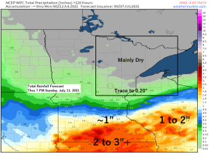
An extended period of dry weather will be returning to the entire Northland starting on Wednesday, but I will be keeping an eye on a system over the Midwest this weekend (black outlined area) which right now looks like will remain well south of our area, but if the storm track shifts farther north, then we could see some showers in parts of the Northland especially as we head into early next week (July 12-13 time frame) but those chances are looking pretty slim right now, regardless there’s plenty of time to watch model trends on this next system.

Tim
Leave a Reply